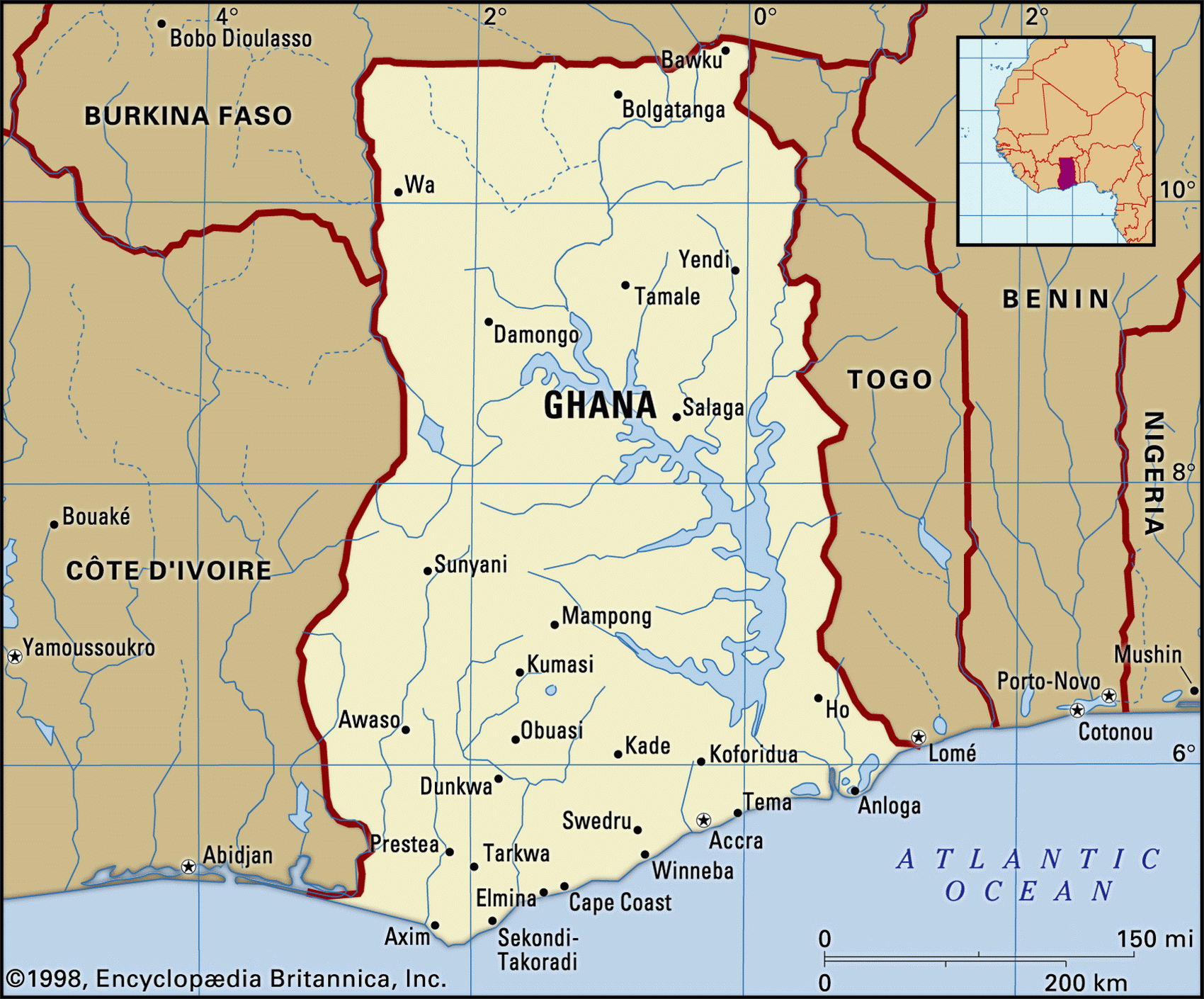
Ghana mapMap of Cuba and geographical facts

Ghana Fact File
Official name Republic of Ghana
Form of government Republic with single legislative body (Parliament)
Capital Accra
Area 238,540 sq km (92,100 sq miles)
Time zone GMT
Population 20,245,000
Projected population 2015 26,378,000
Population density 84.9 per sq km (219.8 per sq mile)
Life expectancy 56.3
Infant mortality (per 1,000) 52.2
Official language English
Other languages Indigenous languages, including Akan, Mole-Dagbani, Ewe
Literacy rate 64.5%
Religions Indigenous beliefs 38%, Muslim 30%, Christian 24%, other 8%
Ethnic groups Indigenous 99.8% (including Akan 44%, Moshi-Dagomba 16%, Ewe 13%, Ga 8%), European and other 0.2%
Currency Cedi
Economy Agriculture 59%, services 30%, industry 11 %
GNP per capita US$ 1,980
Climate Tropical: warm and arid on southeast coast; hot and humid in southwest; hot and arid in north
Highest point Mt Afadjato 880 m (2,887 ft)
Map reference Page 364
Ghana was once known as the Gold Coast. A well-known source of gold in west Africa for a thousand years, the nation's modern name comes from the Ghana Empire of the eighth to the twelfth centuries. The Ashanti people established themselves in the seventeenth century, selling slaves to Portuguese, British, Dutch and Danish traders. Under British control from 1874, Ghana became the first tropical African colony to win independence in 1956. Soon after this it became a Soviet-style one-party state.
After 1966, Ghana was wracked by military coups for fifteen years before Flight-Lieutenant Jerry Rawlings took control in 1981. An election in 1996 returned Rawlings to power once more. In 2000 he could not run again since the constitution only allows for two terms. Although government pressure is often brought to bear, vigorous political debate takes place in a relatively free media, and despite economic troubles Ghana still has twice the per capita output of the poorer countries in west Africa.
Geographically, the country is formed by the basin of the Volta Rivers. A large area flooded by the Akosombo Dam is now Lake Volta. This provides hydroelectric power for smelting alumina into aluminum, and for use in the towns, mines, and industries of the Takoradi-Kumasi-Tema triangle. In the north there is savanna country. In earlier days the southern part of the country was covered by dense tropical forest. Much of this has been cleared for agriculture, especially for growing cocoa, which from 1924 until the present day has usually been the leading export.
Like other west African countries, Ghana has few natural harbors. Its coast consists mainly of mangrove swamps, with lagoons toward the mouth of the River Volta. The rivers are home to crocodile, manatee, and hippopotamus. The wildlife of the northern savanna includes lion, leopard, hyena, and antelope.
Ghana is well endowed with natural resources: gold, timber, industrial diamonds, bauxite, manganese, fish, and rubber. In 1995, largely as a result of increased gold, timber, and cocoa production, overall economic growth was about five percent. Although the economy is based on subsistence agriculture, Ghana is not self-sufficient in food. The government's efforts to reverse the statist policies of decades past continue, but face a number of obstacles. Public sector wage increases, and various peace-keeping missions, both internal and external, have strained the budget and led to inflationary deficit financing. Corruption is a continuing obstacle to growth.