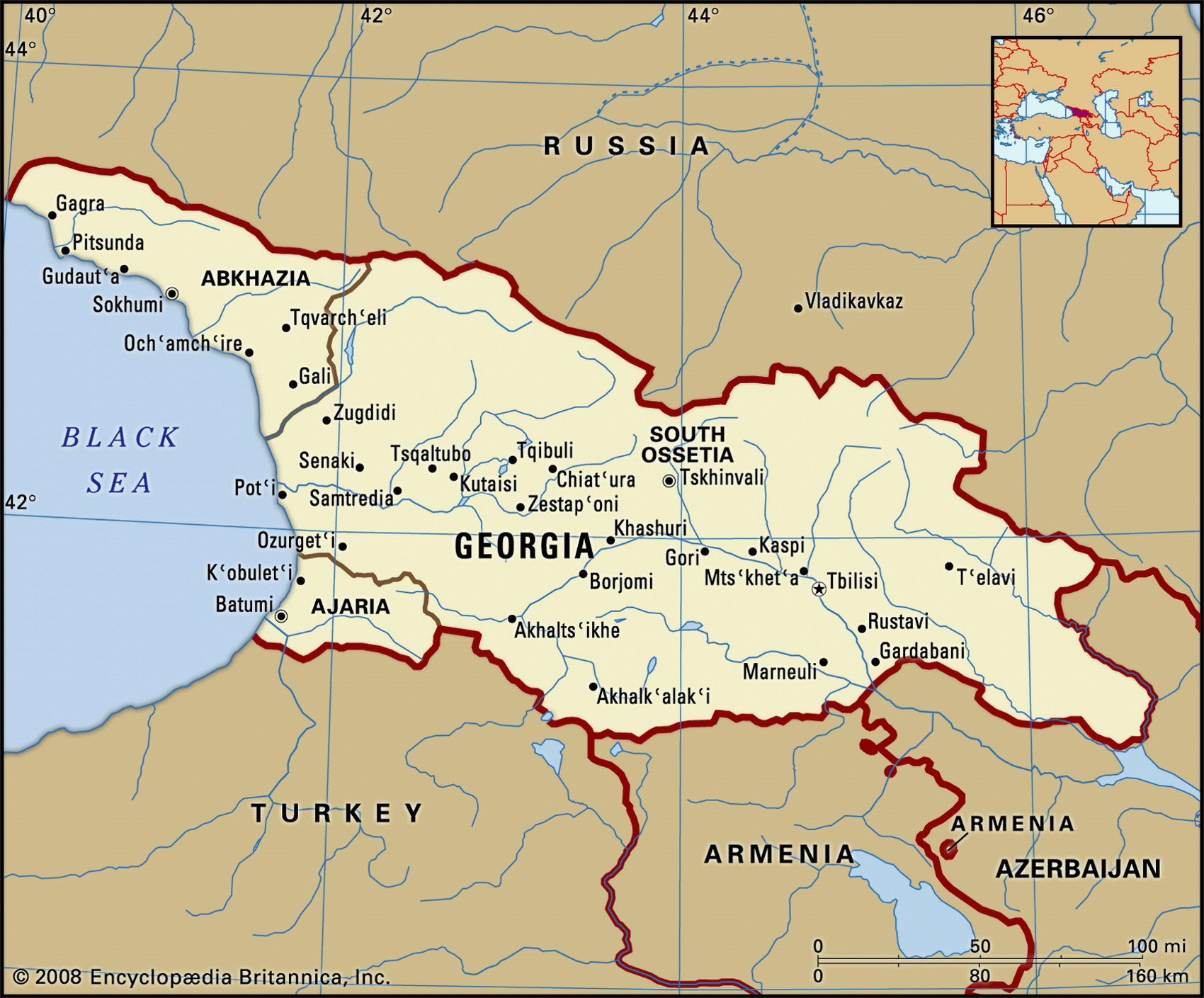
Map of Georgia and geographical facts
Georgia on the world map. Map of Georgia
Map of Georgia with cities. Where Georgia is on the world map. The main geographical facts about Georgia - population, country area, capital, official language, religions, industry and culture.

Fact File Georgia
Official name Republic of Georgia
Form of government Republic with single legislative body (Parliament)
Capital Tbilisi
Area 69,700 sq km (26,911 sq miles)
Time zone GMT + 4 hours
Population 4,961,000
Projected population 2015 4,775,000
Population density 71.2 per sq km (184.3 per sq mile)
Life expectancy 64.7
Infant mortality (per 1,000) 51.8
Official language Georgian
Other languages Russian, Armenian, Azeri, Abkhasian, Ossetian
Literacy rate 99 %
Religions Christian Orthodox 75% (Georgian Orthodox 65%, Russian Orthodox 10%), Muslim 11 %, Armenian Apostolic 8%, unknown 6%
Ethnic groups Georgian 70%, Armenian 8%, Russian 6.5%, Azeri 5.5%, Ossetian 3%, Abkhaz 2%, other 5 %
Currency Lari
Economy Services 44%, industry 31 %, agriculture 25%
GNP per capita US$ 3,100
Climate Temperate, with cool winters and hot, dry summers; subtropical on Black Sea coast
Highest point Gora Kazbek 5,047 m (16,558 ft)
Map reference Page 222
Amountainous country in the shadow of the Great Caucasus (Bol'shoy Kavkas), Georgia lies on the shore of the Black Sea between the Russian Federation and Turkey, and has borders with Armenia and Azerbaijan in the southeast. It has a long national history. The land of the Golden Fleece in Greek mythology (Colchis was today's Plain of Kolkhida) Georgia was conquered by Romans, Persians, Arabs, Tartars, and Turks before falling to the Russians around 1800. Nevertheless, it has a strong culture, with a literary tradition based on a distinctive language and alphabet.
In 1991 Georgia rushed to proclaim its independence from the crumbling Soviet Union. Since then it has been chronically unstable, fighting off internal secessionist demands from both Abkhazia and—until 1994—South Ossetia. The town of Gori is the birthplace of Georgia's most famous son, Josef Stalin.
Georgia has four main areas: the Great Caucasus Range (Bol'shoy Kavkas) to the north which provides a natural boundary with Russia; the Black Sea Plain in the west, including the subtropical Kholkida lowlands; the eastern end of the Lesser Caucasus (Malyy Kavkaz) to the south, whose peaks and plateaus extend into Turkey and Armenia; and a central plateau called the Kartalinian Plain, where the capital of T'bilisi stands, and which divides the northern and southern ranges. Further east, the Kura (Kur) River and its tributaries drain through a number of upland valleys toward Azerbaijan and the Caspian Sea. The mountains contain extensive woodlands (nearly forty percent of the country is forested) with broadleaf beech, oak, and chestnut at lower levels, and a sparse cover of birch on the higher slopes.
Georgia is an agricultural country, and the main industries are food processing and wine production. Collectivization had less impact on Georgia than elsewhere in the Soviet Union, so the recovery of its rural sector post-1991 has been fairly painless. Privately owned plots flourish, agriculture as a whole producing citrus fruits, tea (the main crop), grapes, tobacco, wheat, barley and vegetables, while perfumes are made from flowers and herbs. The Imeretia district has a flourishing silk industry. Other products from a small industrial sector include machinery, chemicals, and textiles. Manganese, copper, cobalt, and vanadium are mined. Tourism was once important, but has been damaged by civil strife. There are severe energy shortages. In the long term, hopes for Georgian economic progress hinge on re-establishing trade ties with Russia, and on international transportation (such as handling oil from Azerbaijan) through its Black Sea ports.