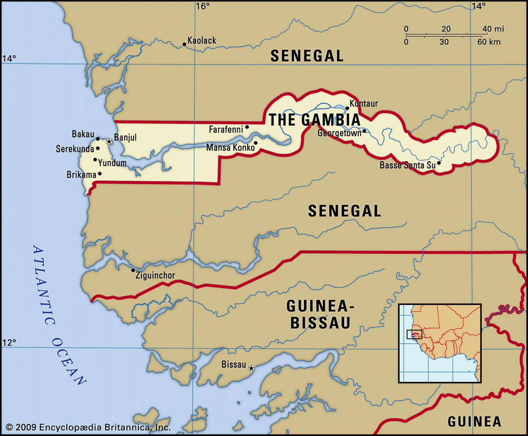
Gambia mapMap of Cuba and geographical facts

Gambia Fact File
Official name Republic of the Gambia
Form of government Republic with single legislative body (House of Representatives)
Capital Banjul
Area 11,300 sq km (4,363 sq miles)
Time zone GMT
Population 1,456,000
Projected population 2015 1,781,000
Population density 128.8 per sq km (333.7 per sq mile)
Life expectancy 54.0
Infant mortality (per 1,000) 76.4
Official language English
Other languages Indigenous languages (including Madinka, Wolof, Fula), Arabic
Literacy rate 47.5(
Religions Muslim 90%, Christian 9%, indigenous beliefs 1 %
Ethnic groups Indigenous 99% (including Mandinka 42 %, Fula 18 %, Wolof 16 %, Jola 10%, Serahuli 9%), non-Gambian 1 %
Currency Dalasi
Economy Agriculture 75%; industry, commerce, and services 19%; government 6%
GNPper capita US$ 1,770
Climate Tropical, with wet season June to November
Highest point Unnamed location 53 m (174 ft) Map reference Page 364
Surrounded on nearly all sides by Senegal, Gambia is Africa's smallest independent state. Once a part of the Mali Empire, it became a British colony in 1816 and has been independent since 1965. Following independence it was governed for almost thirty years by Sir Dawda Jawara and the People's Progressive Party. A military coup displaced him in 1994. In 1996 a new constitution was adopted and the country returned to civil government. The country has been notably stable since, though resentment of the dominant Mandinka exists among minority tribal groups such as the Fula and Wolof.
A subtropical climate and a sunny dry season has enabled Gambia to expand tourism in recent years but the conflict between tourist life and the main religion, Islam, has made this controversial. In 1982 Gambia joined its neighbor, Senegal, in a union named the Senegambian Federation. This proved unsuccessful and was dissolved in 1989.
The Gambia River and its estuary are navigable for some 200 km (125 miles), allowing ships of up to 3,000 tonnes to reach Georgetown. Consisting of a riverine plain running inland 275 km (170 miles) from the estuary, Gambia's countryside is low and undulating, the land beside the river varying from swamp to savanna. Although rice is grown in the swamps and on the river floodplain, not enough is produced to meet domestic needs. Millet, sorghum, and cassava are grown on higher ground. On the upper river, a dam provides irrigation.
Gambia has unmined deposits of minerals such as ilmenite, rutile, and zircon. The economy has a limited agricultural base, with three-quarters of the population growing crops and raising livestock. Peanuts are the main cash crop, providing more than 75 percent of export earnings, and peanut processing is important industrially. Palm kernels are also exported. Because Banjul is the best harbor on the west African coast, much Senegalese produce passes through Gambia, and re-export forms one-third of economic activity.