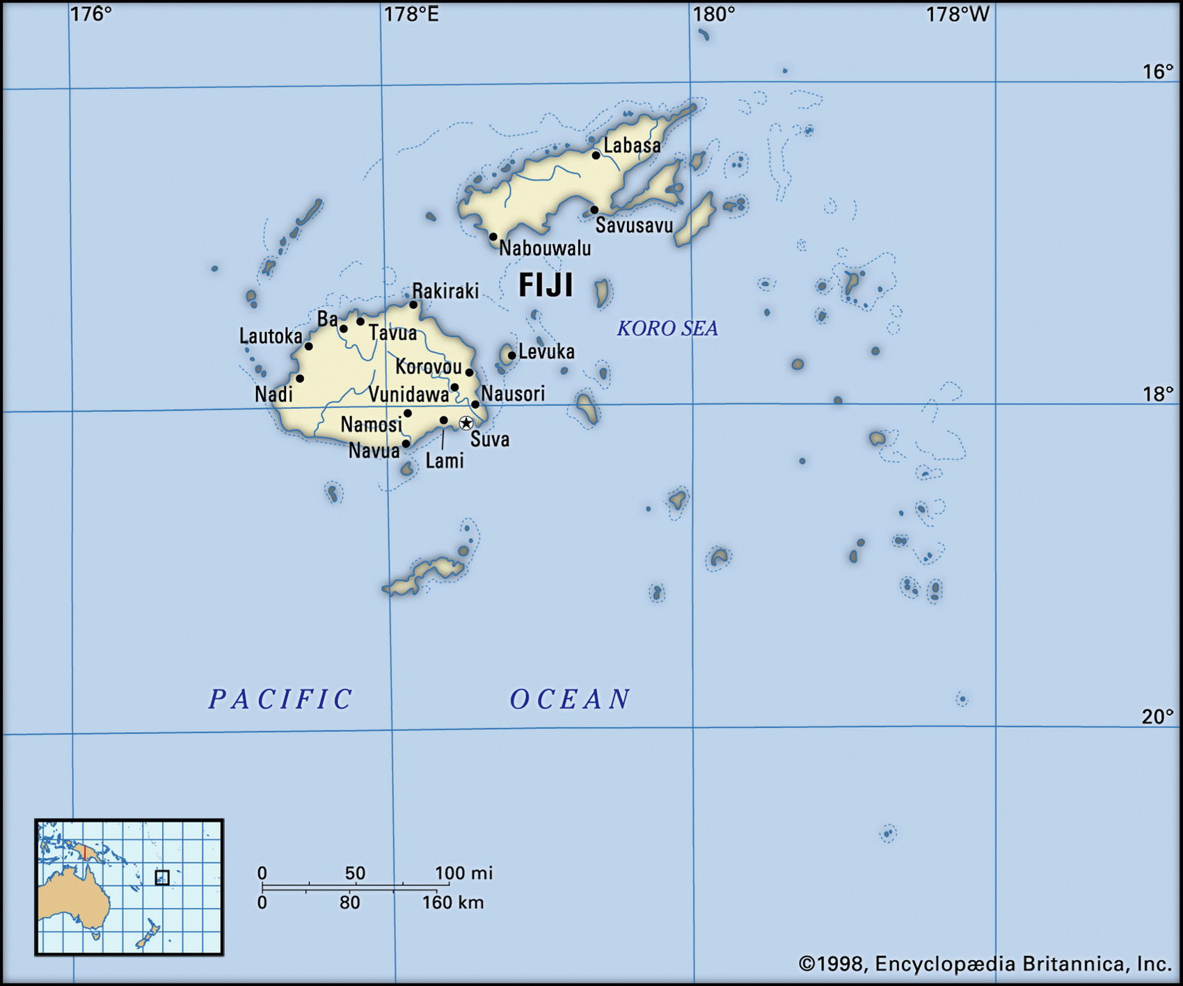
Map of Fiji and geographical facts
Where Fiji on world map. Map of Fiji
Map of Fiji with cities. Where Fiji is on the world map. The main geographical facts about Fiji - population, country area, capital, official language, religions, industry and culture.

Fact File Fiji
Official name Republic of Fiji
Form of government Republic with two legislative bodies (Senate and House of Representatives)
Capital Suva
Area 18,270 sq km (7,054 sq miles)
Time zone GMT + 12 hours
Population 857,000
Projected population 2015 925,000
Population density 44.5 per sq km (121.5 per sq mile)
Life expectancy 68.6
Infant mortality (per 1,000) 13.7
Official language English
Other languages Fijian, Hindustani
Literacy rate 92.5%
Religions Christian 52% (Methodist 37%, Roman Catholic 9%), Hindu 38%, Muslim 8%, other 2 %
Ethnic groups Fijian 49%, Indian 46%, other (including European, other Pacific Islanders, Chinese) 5 %
Currency Fiji dollar
Economy Agriculture 67%, services and industry 33%
GNP per capita US$ 5,200
A coastal village in the Solomon Islands, with some Second World War pontoons (left page top). The Parliament House buildings in Suva, Fiji (above). Fruit and vegetables for sale at Port Vila Market, Vanuatu (below).
Climate Tropical, with wet season November to April Highest point Mt Tomanivi 1,324 m (4,344 ft) Map reference Pages 137, 141
Fiji consists of an archipelago of more than 800 islands and islets, 110 of them inhabited, located about two-thirds of the way from Hawaii to New Zealand. Lying on the air route from Australia to the west coast of the USA, Fiji is well served by flights, and is attracting an increasing number of tourists. Originally inhabited by Melanesian islanders organized into a number of tribes, the islands were visited by Dutch explorers in 1643, and from 1800 attracted growing numbers of traders, along with missionaries who converted the people to Christianity. A period of intense tribal warfare was brought to an end when the paramount chief ceded sovereignty to the British in 1874. Five years later, in 1879, the British began bringing in Indian laborers for the purpose of sugar production; by the time Fiji obtained its independence in 1970 their descendants outnumbered the country's ethnic Fijians.
Racial divisions have caused tension and instability, as for many years the Indian immigrants were treated as second-class citizens, despite their vital role in the sugar industry. A coup in 1987, led by a Fijian army officer against a democratically elected government in which Indians were the majority, led to a new constitution in 1990 which was racially weighted to ensure permanent indigenous Fijian rule. Many Indian-Fijians emigrated as a result. In May 1999, the Indian leader of the Fijian Labor Party, Mahandra Chaudrey, was democratically elected Prime Minister. In May 2000, coup plotters, led by indigenous Fijian George Speight, took Chaudrey and other parliamentarians hostage, resulting in a period of martial law until March 2001.
The main islands are of volcanic origin. About seventy percent of the population live on the two biggest—Viti Levu and Vanua Levu. These have a sharp and rugged relief, rising to Mt Tomanivi on Viti Levu. The islands lie in a cyclone path (Cyclone Kina caused much damage in 1993) and trade winds bring heavy rain to their eastern sides. Dense tropical forest covers the higher slopes. Sugarcane is grown on the fertile coastal plains, sugar exports and tourism with 250,000 visitors per year being Fiji's main sources of foreign exchange. Fiji has one of the most developed of the Pacific island economies, producing (as well as sugar) copra, gold, silver, clothing, and timber.