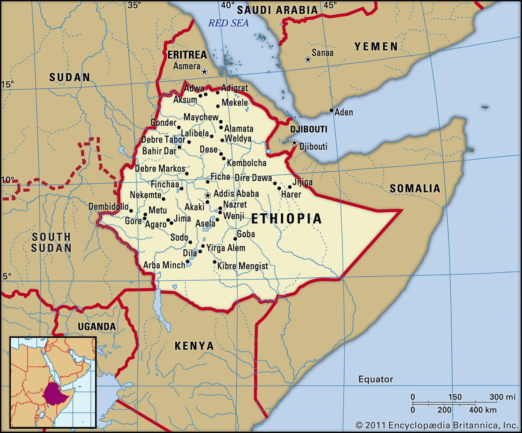
Map of Ethiopia and geographical facts
Ethiopia on the world map. Map of Ethiopia
Map of Ethiopia with cities. Where Ethiopia is on the world map. The main geographical facts about Ethiopia - population, country area, capital, official language, religions, industry and culture.

Ethiopia Fact File
Official name Federal Democratic Republic of Ethiopia
Form of government Federal republic with two legislative bodies (Federal Council and Council of People's Representatives)
Capital Adis Abeba (Addis Ababa)
Area 1,127,127 sq km (435,184 sq miles)
Time zone GMT + 3 hours
Population 67,673,000
Projected population 2015 89,765,000
Population density 60.0 per sq km (155.5 per sq mile)
Life expectancy 44.2
Infant mortality (per 1,000) 98.6
Official language Amharic
Other languages More than 100 indigenous languages, Arabic, English
Literacy rate 35.5%
Religions Muslim 45 %-50%, Ethiopian Orthodox 35%-40%, animist 12%, other 3%-8%
Ethnic groups Oromo 40%, Amhara and Tigrean 32%, Sidamo 9%, Shankella 6%, Somali 6%, Afar 4%, Gurage 2%, other 1 %
Currency Birr
Economy Agriculture 80%, services 12%, industry 8%
GNP per capita US$ 700
Climate Tropical on lowlands, uplands more temperate; wet season April to September
Highest point Ras Dashen Terara 4,620 m (15,157 ft)
Map reference Pages 366-67
Ethiopia was known as the land of Punt by the Ancient Egyptians. In the fourth century ad it adopted Coptic Christianity, and despite strong Islamic influences since that time, including a Muslim invasion in 1523, many people remain Christian today. Although Mussolini's Italy occupied the country between 1935 and 1941, Ethiopia was never a colony—in fact under Emperor Haile Selassie it had imperial ambitions, and attempted to subjugate both the Somalis and the people of Eritrea. Haile Selassie was deposed in 1974 by a military coup; this triggered a civil war that exacerbated the effects of the famine in 1984. Always poor, Ethiopia is currently destitute— thirty years of war and resulting famine are the legacy of the Marxist dictatorship of Mengistu Haile Mariam. His regime ended in 1991, when he was deposed.
The landscape is dominated by a mountainous volcanic plateau divided in two by the Rift Valley. The western highlands, with an average height of 2,700 m (8,800 ft), are the source of the Blue Nile, which spills out in a cataract from Lake Tana to flow south and west, before finally flowing north into Sudan. East of the western highlands is the Danakil Desert, where a depression falls to 116 m (380 ft) below sea level. This is one of the hottest places on earth. In the highlands, however, the climate is moderate to warm, with frosts at night and occasional falls of snow on the mountains. The eastern highlands below the Rift Valley fall away to the border with Somalia. In the aftermath of Ethiopia's war with its Somali neighbor the southern section of this border is only provisional, and there is an ongoing dispute regarding the Ogaden region.
More than ninety percent of the country's industry, concerned with food processing, the manufacture of textiles, and chemical and metal production, is owned and managed by the state. Inefficiencies and overstaffing are widespread. This is the result of the Mengistu regime's effort to establish a centrally controlled Soviet-model economy. Various reform measures have been proposed and the government intends to sell off some state-owned plants, but progress is slow.
Drought in the years 1981 to 1985, combined with an unsuccessful attempt to collectivize agriculture, resulted in a famine in which an estimated 1 million people died. Today, rural production accounts for half of gross domestic product and eighty percent of employment. Repair of war-damaged roads and railways continues. Although Ethiopia still needs food aid there is a growing emphasis on aid in the form of credit for infrastructure development.