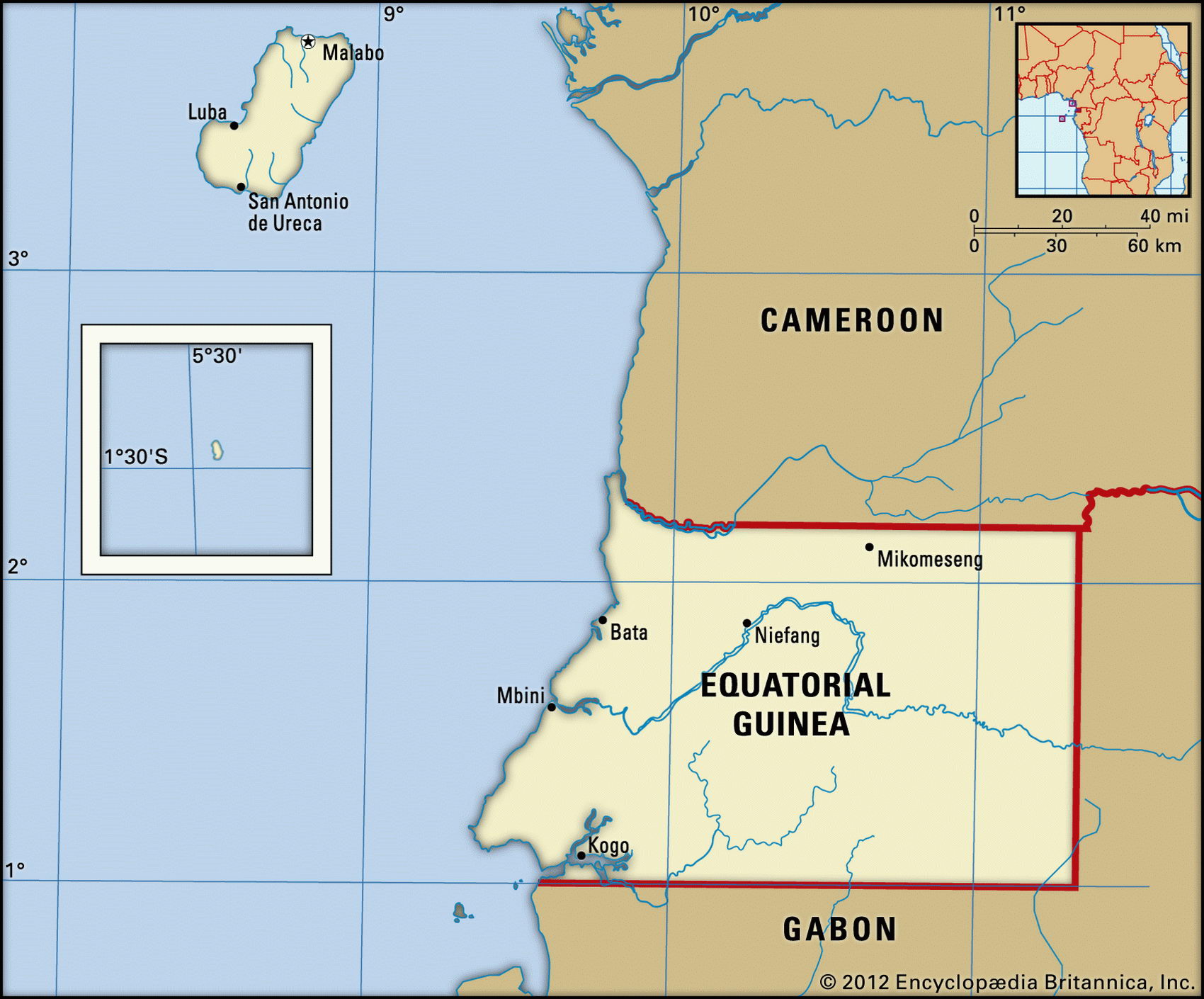
Map of Equatorial Guinea and geographical facts
Equatorial Guinea on the world map. Map of Equatorial Guinea
Map of Equatorial Guinea with cities. Where Equatorial Guinea is on the world map. The main geographical facts about Equatorial Guinea - population, country area, capital, official language, religions, industry and culture.

Equatorial Guinea Fact File
Official name Republic of Equatorial Guinea
Form of government Republic with single legislative body (House of People's Representatives)
Capital Malabo
Region Central Africa
Area 28,050 sq km (10,830 sq miles)
Time zone GMT + 1 hour
Population 499,000
Projected population 2015 692,000
Population density 17.8 per sq km (46.1 per sq mile)
Life expectancy 54.4
Infant mortality (per 1,000) 91.0
Official language Spanish
Other languages Indigenous languages, including Fang, Bubi, Ibo; pidgin English
Literacy rate 78.5 %
Religions Roman Catholic 85%, indigenous beliefs 15%
Ethnic groups Fang 80 %, Bubi 15 %, other 5 %
Currency CFA (Communaute Financiere Africaine) franc
Economy Agriculture 66%, services 23%, industry 11 %
GNP per capita US$2,100
Climate Tropical; wetter on coast
Highest point Pico Basile 3,011 m (9,879 ft)
Map reference Page 365
Equatorial Guinea consists of five islands in the Gulf of Guinea, plus the small mainland area of Rio Muni that lies between Cameroon and Gabon. The largest of the islands, Bioco, was originally Portuguese, and was known for centuries as the slave depot and trans-shipment base of Fernando Po. The Spanish took over in 1778.
After gaining independence from Spain in 1968 Equatorial Guinea fell into the hands of Francisco Macias Nguema. A member of the Mongomo clan of the Fang tribe, his bloody and despotic rule lasted eleven years, after which he was overthrown and later executed. His nephew, also a Fang, continued to govern in much the same way, observers describing the presidential elections of 1996 and 2002 as a political farce.
Equatorial Guinea illustrates the problems faced by tribal groups trying to adapt to democratic political arrangements.
The island of Bioco is mountainous and volcanic, with fertile soils. It has long supported cocoa on the lowland, and there are coffee plantations on the higher slopes which rise to Pico Basile. Rugged terrain and waterfalls are found in the southern half of the island. On the thinly populated area of mainland, mangrove swamps along the coast lead inland to dense tropical forests. Here, foreign companies have timber concessions, felling okoume and mahogany.
In addition to timber, the country exports cocoa and coffee. In the years before independence, cocoa plantations on Bioco and the mainland provided Equatorial Guinea with the highest per capita income in west Africa. By the end of the Macias era, however, the state was in political and economic ruins and some 100,000 of the population had fled as refugees to neighboring countries. Most of those who remain in the country today are subsistence farmers growing yams, cassava, and bananas.
Equatorial Guinea has a variety of undeveloped mineral resources: titanium, iron ore, manganese, uranium, and alluvial gold. Recently oil exploration has been successful, and increased production of oil and natural gas is anticipated. Aid programs are currently in limbo, having been cut off because of gross governmental corruption and mismanagement.