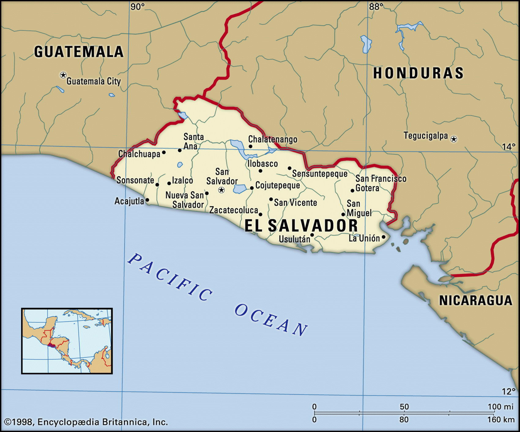
Map of El Salvador and geographical facts
El Salvador map with cities. El Salvador on the world map
Map of El Salvador with cities. Where El Salvador is on the world map. The main geographical facts about El Salvador - population, country area, capital, official language, religions, industry and culture.

El Salvador Fact File
Official name Republic of El Salvador
Form of government Republic with single legislative body (Legislative Assembly)
Capital San Salvador
Area 21,040 sq km (8,123 sq miles)
Time zone GMT - 6 hours
Population 6,354,000
Projected population 2015 7,979,000
Population density 302 per sq km (782.2 per sq mile)
Life expectancy 70.3
Infant mortality (per 1,000) 27.6
Caye Caulker, an island off the coast of Belize that is popular with scuba divers (left page top). An aerial view of Tegucigalpa, the capital of Honduras (left page bottom). El Salvador contains about twenty volcanoes, some still active. Izalco Volcano, El Salvador, seen from lush forest (left).
Official language Spanish
Other language Indigenous languages (Nahua, Maya)
Literacy rate 71.5%
Religions Roman Catholic 75 %, Protestant and other 25 %
Ethnic groups Mixed indigenous-European 94%, indigenous 5%, European 1 %
Currency Colon
Economy Services 70%, industry 22%, agriculture 8%
GNP per capita US$ 4,600
Climate Tropical, with wet season May to October; cooler in mountains
Highest point Cerro El Pittal 2,730 m (8,957 ft)
Map reference Page 428
El Salvador is the smallest, most densely populated country in Central America, and the only one without a coast on the Caribbean. It is in a seismic zone and has some twenty volcanoes, several of which are active. Once the home of the Pipil Indians and later a part of the Mexican Empire, the country won full independence in 1841 and established itself as the Republic of El Salvador in 1859. Over 100 years of civil strife and military rule followed.
From the 1880s about 75 percent of the land has been in the hands of 14 families, who farm huge plantations producing coffee, tobacco, and sugar. The potential for conflict between this landed oligarchy and the rural poor has been present since that time and in the 1970s left-wing disillusionment with the electoral process led to the formation of a number of guerrilla groups. Between 1979 and 1991 civil war raged, with the loss of 75,000 lives, and many people emigrated. The political and economic effects of this conflict are still evident.
Behind El Salvador's narrow Pacific coastal plain rises a volcanic range. Inland is a rich and fertile central plain, occupying 25 percent of the country's total land area. The urban and rural population in this area accounts for sixty percent of the country's total, and produces ninety percent of El Salvador's coffee and tobacco, along with most of its sugar and corn. Further inland still, along the frontier with Honduras, are mountain ranges. Once forested and unpopulated, they now draw poor farmers desperate for land.
El Salvador's economy has few strengths other than a large amount of cheap labor. Damage from the civil war is estimated at $2 billion and cotton and sugar cultivation declined significantly during the conflict. Coffee contributes about ninety percent of exports. Foreign aid remains important, much coming from the USA. Manufacturing is based on food and beverage processing, while other industries are textiles, clothing, petroleum products, and cement. The civil war brought tourism to a standstill but peace has resulted in visitors returning to the Pacific beach resorts of El Salvador's Costa del Sol.