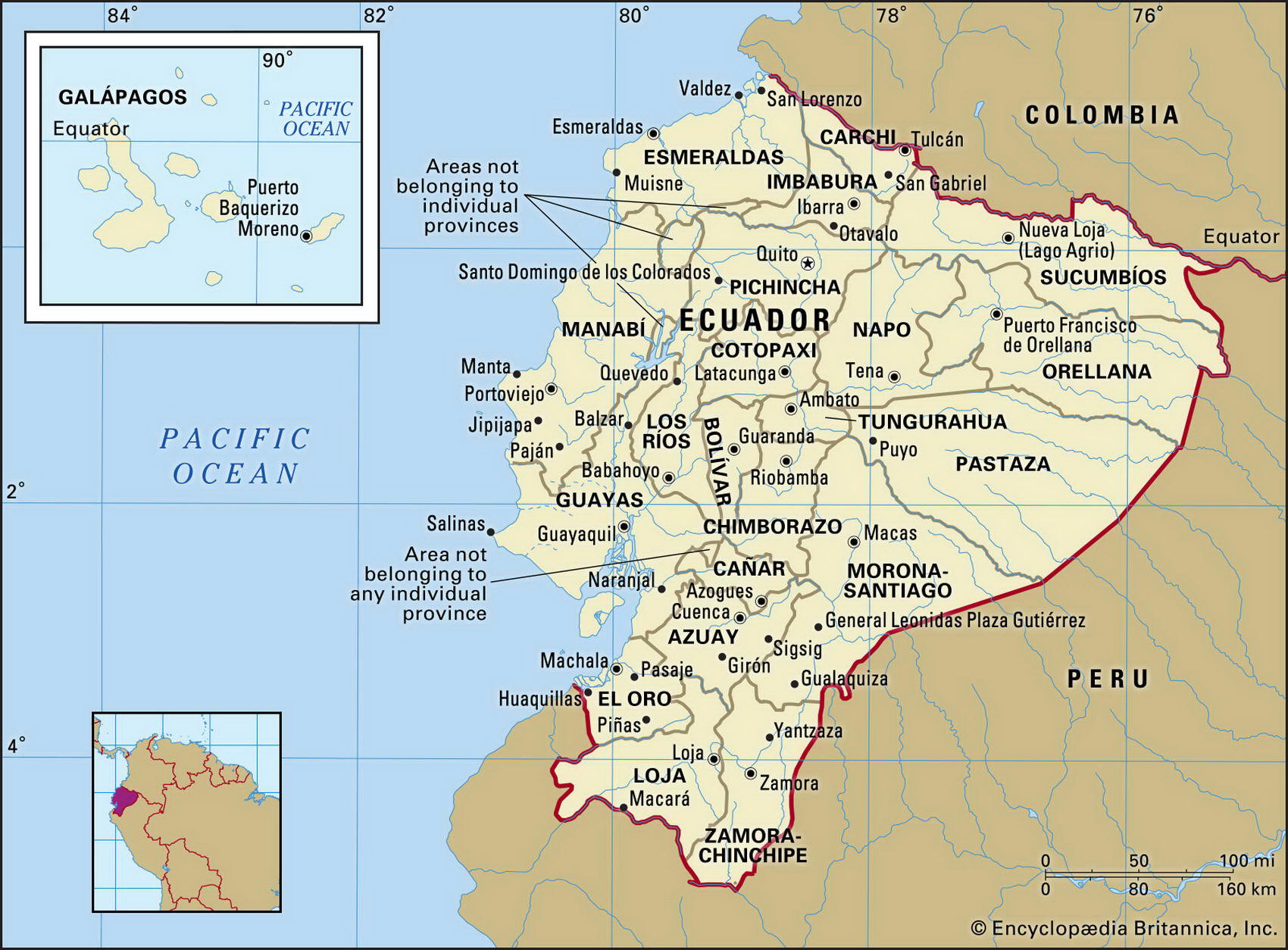
Map of Ecuador and geographical facts
Ecuador on the world map. Map of Ecuador with cities
Map of Ecuador with cities. Where Ecuador is on the world map. The main geographical facts about Ecuador - population, country area, capital, official language, religions, industry and culture.

Ecuador Fact File
Official name Republic of Ecuador
Capital Quito
Time zone GMT-5 hours
Population 13,445,000
Form of government Republic with single legislative body (National Congress)
Area 283,560 sq km (109,483 sq miles)
Projected population 2015 16,329,000
Population density 47.4 per sq km (122.8 per sq mile)
Life expectancy 71.6
Infant mortality (per 1,000) 33
Official language Spanish
Other languages Indigenous languages, particularly Quechua and Chibcha
Literacy rate 90.1 %
Religions Roman Catholic 95 %, other 5 %
Ethnic groups Indigenous-European 55%, indigenous 25%, Spanish 10%, African 10%
Currency Sucre
Economy Services 42 %, agriculture 39 %, industry 19%
GNP per capita US$ 3,000
Climate Tropical on coast and plains, cooler in highlands
Highest point Chimborazo 6,310 m (20,702 ft) Map reference Page 450
Ecuador is the smallest of the Andean republics, taking its name from the equator which divides it in half. Quito was briefly an Inca city before being conquered by the Spanish in the 1530s. The city is ringed by volcanoes, including Cotopaxi (5,896 m; 19,344 ft), the world's highest active volcano. The groups of Indians that form 25 percent of the population are pressing for recognition as distinct nationalities within the state.
Ecuador's agriculture is based on the coastal plains where more than half of the arable land
The volcano Cotopaxi in Ecuador (top). Pigs for sale at the market at Otavalo, Ecuador (above).
can be found. Bananas, coffee, and cocoa are the main crops. Most production is on haciendas—huge estates established during the early years of Spanish occupation. Inland, among the Andes, are valleys where livestock is raised. The eastern slopes of the Andes give way to forested upland and the border with Peru. This region is so little known that hostilities between Peru and Ecuador in 1995 arose partly from uncertainty as to where the frontier should be. This conflict finally was resolved in 1999. Petroleum and natural gas from this area are piped over the Andes to the Pacific port of Esmeraldas.
Ecuador grows more bananas than any other country in the world. Until overtaken by petroleum and natural gas, bananas were its biggest export earner, and access to markets in the United States and the European Union is a continuing concern. The highland Indians survive through subsistence farming, growing maize and potatoes. Recent economic reforms have helped control inflation and increased foreign investment. Growth has been uneven, however, because manufacturing is seriously handicapped by a shortage of electricity.
Ecuador owns the Galapagos Islands, located about 1,000 km (621 miles) off the Pacific coast and home to many unique species of animals such as the giant tortoise, the marine iguana, the flightless cormorant as well as the tree finch. These islands are a popular ecotourism destination, with visitor numbers limited to 40,000 a year so as to protect the fragile ecosystem.