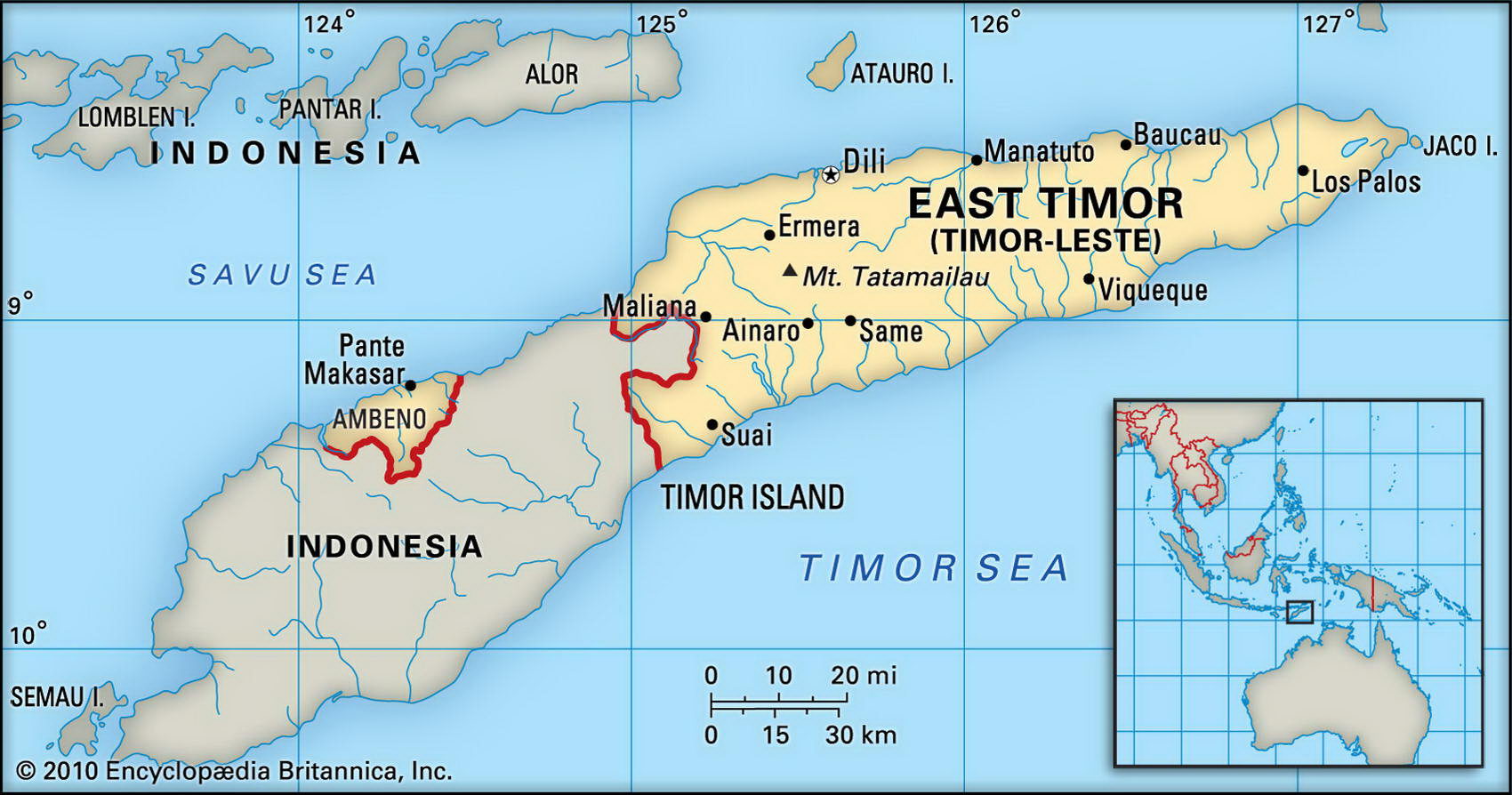
Map of East Timor and geographical facts
Where East Timor on the world map. Map of East Timor
Map of East Timor with cities. Where East Timor is on the world map. The main geographical facts about East Timor - population, country area, capital, official language, religions, industry and culture.

Fact File East Timor
Official name Democratic Republic of Timor-Leste
Form of government Republic with one legislative body
Capital Dili
Area 15,007 sq km (5,794 sq miles)
Time zone GMT +9 hours
Population 998,000
Projected population 2015 1,060,000
Population density 66.5 per sq km (172.2 per sq mile)
Life expectancy 65.2
Infant mortality (per 1,000) 50.5
Official languages Portuguese, Tetum
Other languages English, Bahasa Indonesia, Galole, Mambae, Kemak, and 12 other indigenous languages
Literacy rate 48 %
Religions Roman Catholic 90 %, small minorities of Muslims, Protestants, and Buddhists
Ethnic groups Timoran 78 %, Indonesian 20 %, Chinese 2 %
Currency U.S. Dollar
Economy Agriculture 25.4 %, services 57.4 %, industry 17.2 %
GNP per capita US$475
Climate Tropical, with wet season December to March Highest point Tata Mailau 2,963 m (9,717 ft)
Map reference 198
First settled by the Portuguese in 1520, the eastern part of the island of Timor was annexed by Indonesia in 1976. In 1999, the UN intervened and formed a transitional administration providing the country with its governance that communicates directly with the East Timorese to ensure their participation in the administration. The economy of the mountainous country is based on agricultural produce, pearls, and fishing.