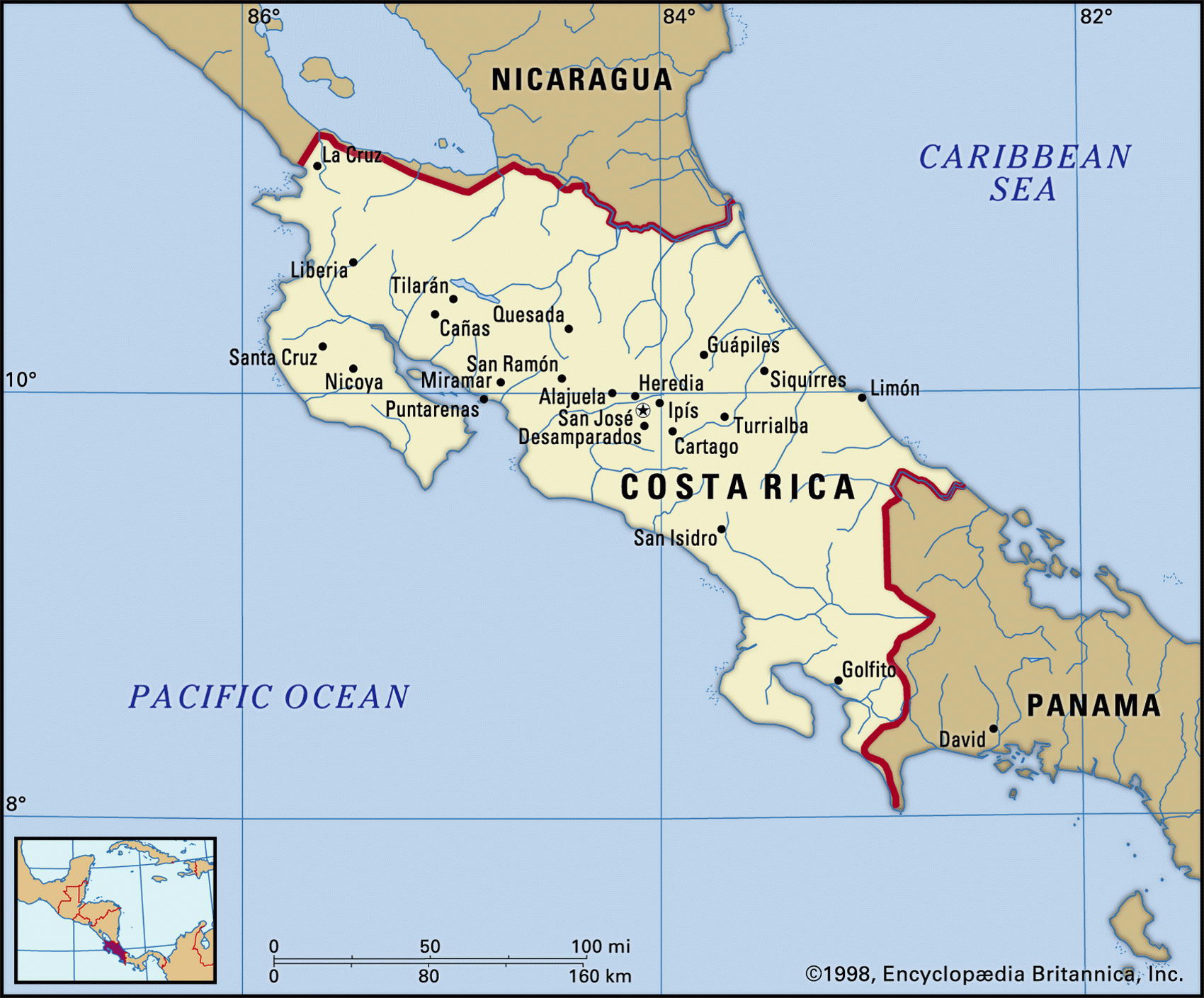
Map of Costa Rica and geographical facts
Costa Rica map with cities. Costa Rica on the world map
Map of Costa Rica with cities. Where Costa Rica is on the world map. The main geographical facts about Costa Rica - population, country area, capital, official language, religions, industry and culture.

Costa Rica Fact File
Official name Republic of Costa Rica
Form of government Republic with single legislative body (Legislative Assembly)
Capital San jose
Area 51,100 sq km (19,730 sq miles)
Time zone GMT - 6 hours
Population 3,835,000
Projected population 2015 5,233,000
Population density 75 per sq km (194.4 per sq mile)
Life expectancy 76.2
Infant mortality (per 1,000) 10.9
Official language Spanish
Other language English
Literacy rate 95.5%
Religions Roman Catholic 95 %, other 5 %
Ethnic groups European and mixed indigenous-European 96%, African 2%, indigenous 1 %, Chinese 1 %
Currency Costa Rican colon
Economy Services 57%, agriculture 25%, industry 18%
GNP per capita US$ 8,500
Climate Tropical, with wet season May to November
Highest point Cerro Chirripo 3,819 m (12,530 ft) Map reference Page 428
Costa Rica lies on the Central American isthmus, between Nicaragua and Panama. Its rainforests and wildlife made it popular with tourists in the 1980s, but rising crime has recently reduced tourist interest. Like a number of other Central American countries it was historically influenced by the civilizations of the Maya and Aztec, and the earliest human settlements go back 10,000 years. It was named by Christopher Columbus in 1502, costa rica meaning "rich coast", and from the 1570s it was a Spanish colony. It gained its independence in 1821 and became a republic in 1848.
Costa Rica is known for its high standards of education, long life expectancy, democratic and stable system of government, high per capita gross domestic product, and a relatively small divide between the rich and the poor. It abolished its national army in 1948. This portrait, however, underestimates the economic role played by US aid in recent times. With aid now reduced, Costa Rican governments have had to take austerity measures, and this has led to unrest.
Three ranges form the mountainous skeleton of the country. From the border of Nicaragua the northern Cordillera de Guanacaste descends to meet the Cordillera Central. Between the Cordillera Central and the southern Cordillera de Talamanca lies the temperate Meseta Central, the valley where San Jose stands. The surrounding area is the main coffee-growing region, coffee production supporting more than fifty percent of the population.
The lowlands on the Caribbean and Pacific coasts are heavily forested and rich in wildlife. While the Pacific side is relatively dry, the Caribbean lowlands receive heavy rain. Both coasts have numerous mangrove swamps and white, sandy beaches. There are several volcanoes on the ranges, some of which are active. Cattle are raised in the dry northwest savanna region of Guanacaste.
Coffee is the country's largest export and along with bananas provides nearly half the country's export earnings. There are large bauxite deposits at Boruca, and aluminum smelting is a major industry. Minerals mined include small quantities of gold, silver, manganese, and mercury. Energy self-sufficiency is being pursued through the development of hydroelectric power.