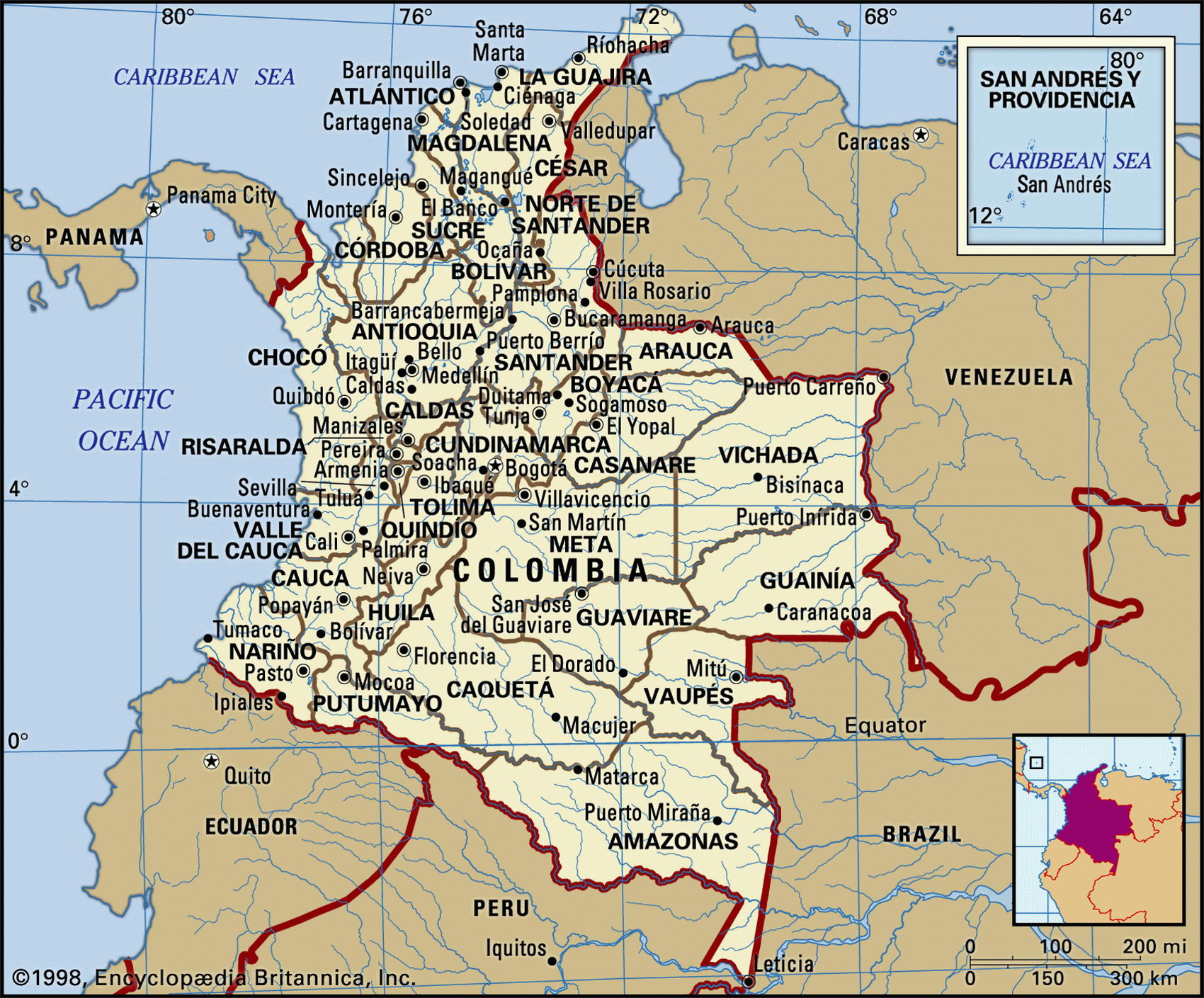
Map of Colombia and geographical facts
Colombia on the world map. Map of Colombia
Map of Colombia with cities. Where Colombia is on the world map. The main geographical facts about Colombia - population, country area, capital, official language, religions, industry and culture.

Colombia Fact File
Official name Republic of Colombia
Form of government Republic with two legislative bodies (Senate and House of Representatives)
Capital Bogota
Area 1,138,910 sq km (439,733 sq miles)
Time zone GMT - 5 hours
Population 41,009,000
Projected population 2015 52,641,000
Population density 36 per sq km (93.3 per sq mile)
Life expectancy 70.9
Infant mortality (per 1,000) 23.2
Official language Spanish
Literacy rate 91.3%
Religions Roman Catholic 95 %, other 5 %
Ethnic groups Mixed indigenous-European 58%, European 20%, mixed European-African 14%,
African 4%, mixed indigenous-African 3%, indigenous 1 %
Currency Colombian peso
Economy Services 46%, agriculture 30%, industry 24%
GNP per capita US$6,300
Climate Tropical along coast and on plains, cool to sometimes cold in highlands
Highest point Pico Cristobal Colon 5,775 m (18,947 ft)
Map reference Pages 450-51
Visited by Hojeda and Vespucci in 1499 and named after Columbus, Colombia straddles the South American continent south of the isthmus of Panama. Once the home of the Chibcha Indians, the country came under Spanish control in 1544, after which it became their chief source of gold. Colombia achieved independence in 1819. From that time on the political and economic fortunes of the country have been contested by the anticlerical free-trading Liberals and the Conservatives, upholders of protectionism and the Church. While Colombia is notorious for its drug cartels and exports of cocaine, it has a diversified and stable economy that has, for thirty years, shown Latin America's most consistent record of growth.
The country can be divided into three regions. The hot, wet Pacific lowlands run south from the Panamanian border; to the north they merge into drier lowlands along the Caribbean. The cities that face the Caribbean—Barranquilla, Santa Marta, and Cartagena—are tourist resorts. Inland, the parallel Andean ranges running north from the Ecuadorian border define the second region, the high valleys of the Cauca and Magdalena Rivers. This is where most people live. The third region comprises the foothills east of the Andes, where the land falls away into the forested basins of the Amazon and Orinoco Rivers. This region amounts to almost two-thirds of Colombia's area but only a few cattle ranchers and Indians live here.
With Latin America's largest proven reserves of coal, Colombia is the region's biggest coal exporter. Some eighty percent of the world's emeralds also come from here. Oil, however, remains the biggest legitimate revenue-earning export. Since 1990 growth in gross domestic product has averaged four percent annually, led by expanding construction and financial service industries, and inflows of foreign capital. Nevertheless, earnings from processed cocaine probably exceed all others. Problems include a poverty index of forty percent, and a continuing political crisis related to allegations of drug connections at high levels.