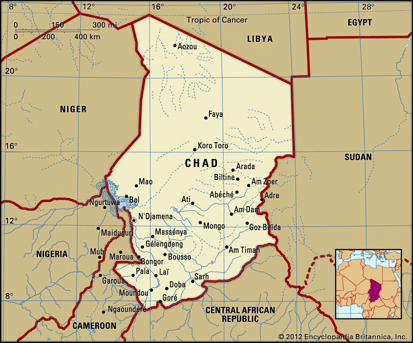
Map of Chad and geographical facts
Chad on the world map. Map of Chad with cities
Map of Chad with cities. Where Chad is on the world map. The main geographical facts about Chad - population, country area, capital, official language, religions, industry and culture.

Chad Fact File
Official name Republic of Chad
Form of government Republic with single legislative body (Higher Transitional Council)
Capital Ndjamena
Area 1,284,000 sq km (495,752 sq miles)
Time zone GMT + 1 hour
Population 8,998,000
Projected population 2015 12,376,000
Population density 7.0 per sq km (18.2 per sq mile)
Life expectancy 51.3
Infant mortality (per 1,000) 93.5
Official languages French, Arabic
Other languages More than 100 indigenous languages
Literacy rate 40 %
Religions Muslim 50%, Christian 25%, indigenous beliefs 25 %
Ethnic groups More than 200 indigenous groups: north mainly Arabic, south mainly African
Currency CFA (Communaute Financiere Africaine) franc
Economy Agriculture 85 %, services and industry 15%
GNP per capita US$ 1,030
Climate Tropical in south, arid in north
Highest point Emi Koussi 3,415 m (11,204 ft)
Map reference Pages 362, 365, 366
Chad is a landlocked North African country twice the size of France. Much of it is semidesert and thinly populated, and it is one of the poorest and least developed countries in the world. Chad was conquered by the Sudanese warlord Rabah Zobeir late in the nineteenth century, but with 200 distinct ethnic groups in the population a sense of national unity has been slow to emerge. After France established control of the region in 1911 it became part of French Equatorial Africa for fifty years, achieving independence in I960. Since then there has been almost constant civil war, aggravated by the main ethnic divide—that between the desert-dwelling Muslim Arabs in the north and the non-Muslim African farmers in the south. Whether the peace treaties of 2002 and 2003 will prove successful remains to be seen.
The country can be loosely divided into four regions. In the center are broad, arid savanna plains. To the north are deserts with large areas of mobile sand dunes along the southern Sahara. In the northwest are the volcanic mountains of the Tibesti, rising to the 3,415 m (11,204 ft) peak of Emi Koussi. Though surrounded by desert these mountains attract rain, and some farming takes place in the valleys. In the south the valleys of the Chari and Logone Rivers support most of Chad's agriculture, including cotton-growing. Both these rivers drain into Lake Chad (Lac Tchad). But a series of droughts has reduced them to little more than streams, while the shallow Lake Chad itself is steadily shrinking as the desert advances.
Chad's economic difficulties have both political and climatic causes. Civil war in the 1980s disrupted agriculture and spread lasting division, while continuing government corruption and its inability to pay its employees have led to resentment in the civil service. Desertification has had an impoverishing effect, especially among pastoral peoples like the Fulbe in the Sahel. While oil production from a field discovered at Doba might provide a significant long-term source of revenue, eighty percent of the population is likely to depend on subsistence farming for some time and the country will continue to rely on foreign aid.