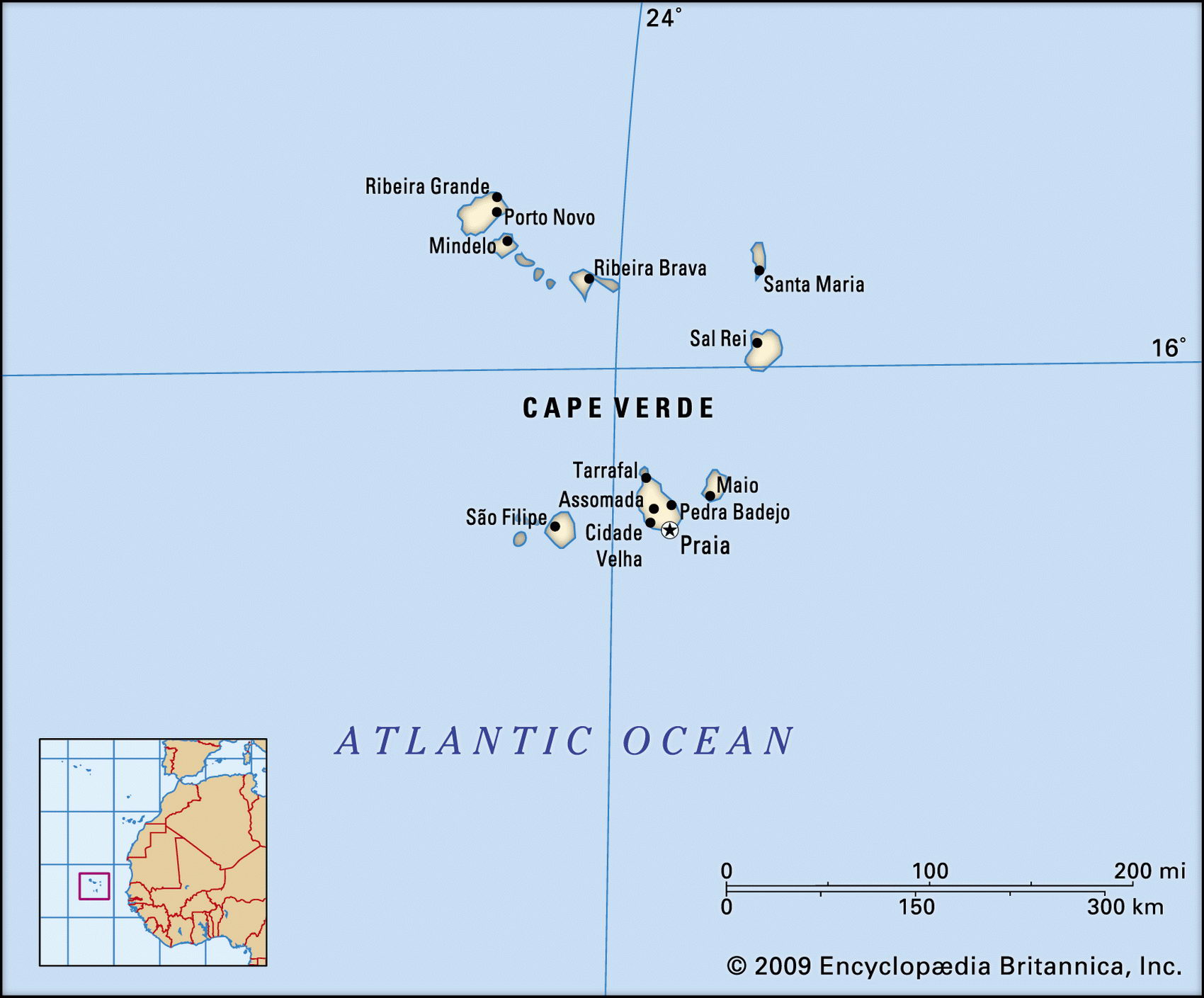
Map of Cape Verde and geographical facts
Cape Verde on the world map. Map of Cape Verde
Map of Cape Verde with cities. Where Cape Verde is on the world map. The main geographical facts about Cape Verde - population, country area, capital, official language, religions, industry and culture.

Cape Verde Fact File
Official name Republic of Cape Verde
Form of government Republic with single legislative body (People's National Assembly)
Capital Praia
Area 4,030 sq km (1,556 sq miles)
Time zone GMT - 1 hour
Population 409,000
Projected population 2015 567,000
Population density 101.5 per sq km (262.9 per sq mile)
Life expectancy 69.5
Infant mortality (per 1,000) 61.9
Official language Portuguese
Other languages Crioulo (blend of Portuguese and West African languages)
Literacy rate 71.6%
Religions Roman Catholic and indigenous beliefs, often in combination 98%; Protestant 2%
Ethnic groups Mixed African-European 71 %, African 28%, European 1 %
Currency Cape Verdean escudo
Economy Agriculture 52%, services 25%, industry 23%
GNP per capita US$ 1,400
Climate Arid, with warm, dry summers
Highest point Pico do Cano (Mt Cano) 2,829 m (9,281 ft)
Map reference Page 360
Cape Verde consists of two small groups of islands 560 km (350 miles) off Dakar, Senegal, on the westernmost part of west Africa. These islands were discovered, uninhabited, • by Portuguese navigators in 1456. For several centuries, until 1876, the islands were used by slave traders as a depot for assembling slaves and provisioning ships. As with other places involved in the slave trade, this activity influenced the composition of the population, with 71 percent being today of Afro-Portuguese background. Portuguese colonial administration came to an end with independence in 1975, but because of limited opportunities on the islands more Cape Verdeans now live abroad than at home. Remittances are an important source of domestic income.
The northern group of islands is called the Barlavento or windward group; the southern is called the Sotavento or leeward group. Volcanic, with slopes weathered into unusual shapes by the wind, the land leads steeply up from the sea to mountainous heights. The active volcano of Mt Cano on the island of Fogo in the southern group is the highest point. The most densely populated areas are the coastal plain of Sao Tiago in the southern group, and Santa Antao and Sao Vicente in the northern group. A chronic lack of water makes agriculture difficult, and most of the productive farming is done in a small number of irrigated inland valleys. Droughts regularly devastate the crops of maize, beans, and sweet potatoes on which the majority of Cape Verdeans live. The effects of the drought that lasted from 1968 to 1982 were so severe that some 40,000 people emigrated to Portugal.
On the economic front Cape Verde faces a number of severe problems. The natural resource base is limited. The only minerals of any significance are salt and pozzolana, a volcanic rock that is used for making cement. Only two food products are exported—fish and bananas, each representing one-third of total exports. Although almost seventy percent of the population lives in the countryside, the gross national product share of agriculture is only thirteen percent, the tuna catch accounting for four percent of that figure. About ninety percent of food is imported and Cape Verde is heavily dependent on foreign aid.