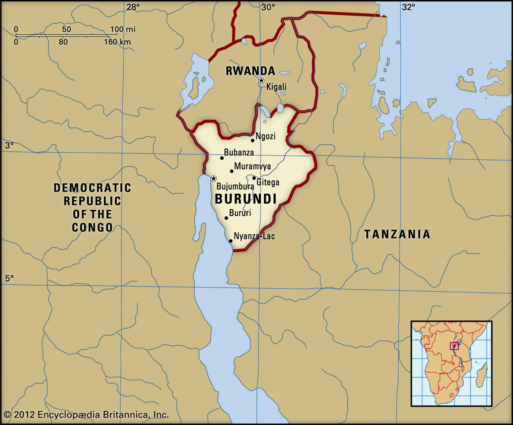
Map of Burundi and geographical facts
Burundi on the world map. Map of Burundi
Map of Burundi with cities. Where Burundi is on the world map. The main geographical facts about Burundi - population, country area, capital, official language, religions, industry and culture.

Burundi Fact File
Official name Republic of Burundi
Capital Bujumbura
Time zone GMT + 2 hours
Population 6,374,000
Form of government Republic with single legislative body (National Assembly)
Area 27,830 sq km (10,745 sq miles)
Projected population 2015 9,835,000
Population density 229.0 per sq km (593.2 per sq mile)
Life expectancy 45.9
Infant mortality (per 1,000) 70.0
Official languages Kirundi, French
Other languages Swahili
Literacy rate 35.3%
Religions Roman Catholic 62%, indigenous beliefs 32%, Protestant 5 %, Muslim 1 %
Ethnic groups Hutu 85 %, Tutsi 14 %, Twa (Pygmy) 1%
Currency Burundi franc
Economy Agriculture 93%, services 5.5%, industry 1.5 %
GNP per capita US$ 600
Climate Tropical, with wet seasons March to May and September to December
Highest point Mt Heha 2,760 m (9,055 ft) Map reference Page 369
Burundi is a small, landlocked country in central Africa. Some time in the past a tall cattle-herding people known as the Tutsi (or Watussi) moved into Burundi from the north. Originating on the Upper Nile, the Tutsi established themselves as a ruling class over the much more numerous and physically shorter Bantu farmers called Hutu. This deeply divided social order has been the source of periodic outbreaks of violence, hundreds of thousands of people having been massacred by both sides. The region's original inhabitants were the forest-dwelling Twa (or Pygmy), but few remain. A new transitional government, inaugurated in 2001, was to be the first step toward holding national elections in 2004.
Burundi's topography resembles other lands along the Rift Valley. A narrow strip along the northeastern shore of Lake Tanganyika forms one boundary, which then extends up the valley of the River Ruzizi in the direction of Lake Kivu. From this lowland area an escarpment rises steeply up to the highlands which make up the rest of the country. The mountainous ridge east of Lake Tanganyika forms a watershed between the river systems of the Congo and the Nile. On its eastern slopes the land then falls away into the valley of the Ruvuvu River as it makes its way toward Tanzania and Lake Victoria. Malaria in the lowlands is endemic, a situation the continuing civil disorder makes difficult to change.
About ninety percent of Burundi's people depend on subsistence agriculture, growing corn, sorghum, sweet potatoes, bananas, and manioc. The Tutsi herders produce meat and milk. Export earnings come mainly from coffee, which contributes 81 percent, along with tea, cotton grown in the Ruzizi Valley, and hides. Three factors affect foreign exchange earnings and government revenue: the vagaries of the climate, international coffee prices, and civil unrest. Even when the first two are favorable, the struggle between Tutsi and Hutu which has been a continuing feature of Burundi life since 1993 as well as the fact that approximately 670,000 refugees from the neighboring Rwanda and Democratic Republic of the Congo live here has virtually brought cash cropping to a halt. Under the direction of the International Monetary Fund the government has tried to diversify exports but continuing discord makes it difficult to implement reforms.