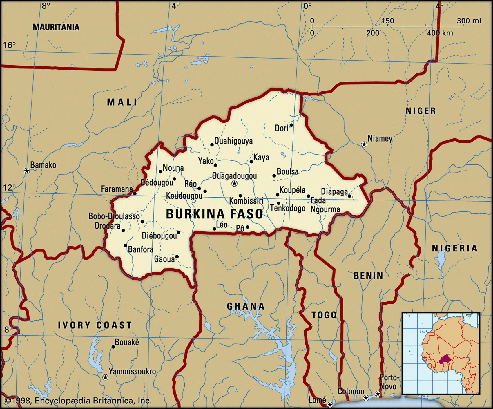
Map of Burkina Faso and geographical facts
Burkina Faso on the world map. Map of Burkina Faso
Map of Burkina Faso with cities. Where Burkina Faso is on the world map. The main geographical facts about Burkina Faso - population, country area, capital, official language, religions, industry and culture.

Burkina Faso Fact File
Official name Burkina Faso
Form of government Republic with single legislative body (Assembly of People's Deputies)
Capital Ouagadougou
Area 274,200 sq km (105,869 sq miles)
Time zone GMT
Population 12,304,000
Projected population 2015 18,509,000
Population density 44.9 per sq km (116.2 per sq mile)
Life expectancy 46.1
Infant mortality (per 1,000) 105.3
Official language French
Other languages Indigenous languages, Arabic, English
Literacy rate 36 %
Religions Muslim 50%, indigenous beliefs 40%, Roman Catholic 8%, Protestant 2%
Ethnic groups More than fifty indigenous tribes: the largest Mossi 48%, Fulani 10%, Mande 9%; other including Gurunsi, Senufo, Lobi, Bobo 33%
Currency CFA (Communaute Financiere Africaine) franc
Economy Agriculture 87%, services 9%, industry 4%
GNP per capita US$ 1,040
Climate Tropical, with warm, dry winters and hot, wet summers
Highest point Tena Kourou 749 m (2,457 ft) Map reference Page 364
Burkina Faso is a landlocked African country on the southern edge of the Sahara Desert. It is the size of Italy but has difficulty supporting its people. The desertification of the Sahel—the fringe of the Sahara running from Senegal to Chad—has severely affected large areas, though the parched savanna of the north and east still supports a nomadic population of cattle-herding Fulani. French colonial control was established between 1895 and 1897 and independence came in I960. There were many military coups until 1992, accompanied by waves of executions, mostly the result of tribal power struggles. However, in 1992 Mali's first democratic election was held and Alpha Konare became president. After his reelection in 1997, he continued his political and economic reforms. In keeping with Mali's two-term constitutional limit, he stepped down in 2002 and was succeeded by Amadou Toure.
Near the capital city of Ouagadougou live the Mossi, the traditional rulers and the dominant tribal group, who have been in the region since the twelfth century. They grow sorghum and millet for food, and cultivate cash crops such as peanuts, cotton, and sesame seeds.
In the west and south is a sandstone plateau, while in the southwest are the spectacular Banfora Cliffs. The plateau is cut by the watercourses of the Red, White, and Black Volta Rivers (Volta Rouge, Blanche, and Noir), draining towards Ghana. Although these valleys have more farming potential than the arid north, they cannot yet be developed because of the tsetse and simulium flies that flourish near their rivers. At present the diseases carried by these insects prevent settlement.
Burkina Faso has few natural resources. There is manganese in the far northeast, but to develop it a 350 km (220 mile) extension of the Cote d'lvoire railway from Abidjan is needed. Industries consist of unprofitable state corporations, a legacy of the country's years as a one-party socialist state. About ten percent of the land area is arable and more than eighty percent of the people work on the land. Drought has caused acute agricultural difficulties and the country depends heavily on foreign aid. Many people have emigrated, their wages, sent back from places such as the Cote d'lvoire, providing much-needed income for their families. Tourists visit the Pares Nationaux du W. du Niger, in the east—a reserve shared with Niger and Benin. Gazelles, antilopes, elephants, cape buffalo, and hippopotamus live there.