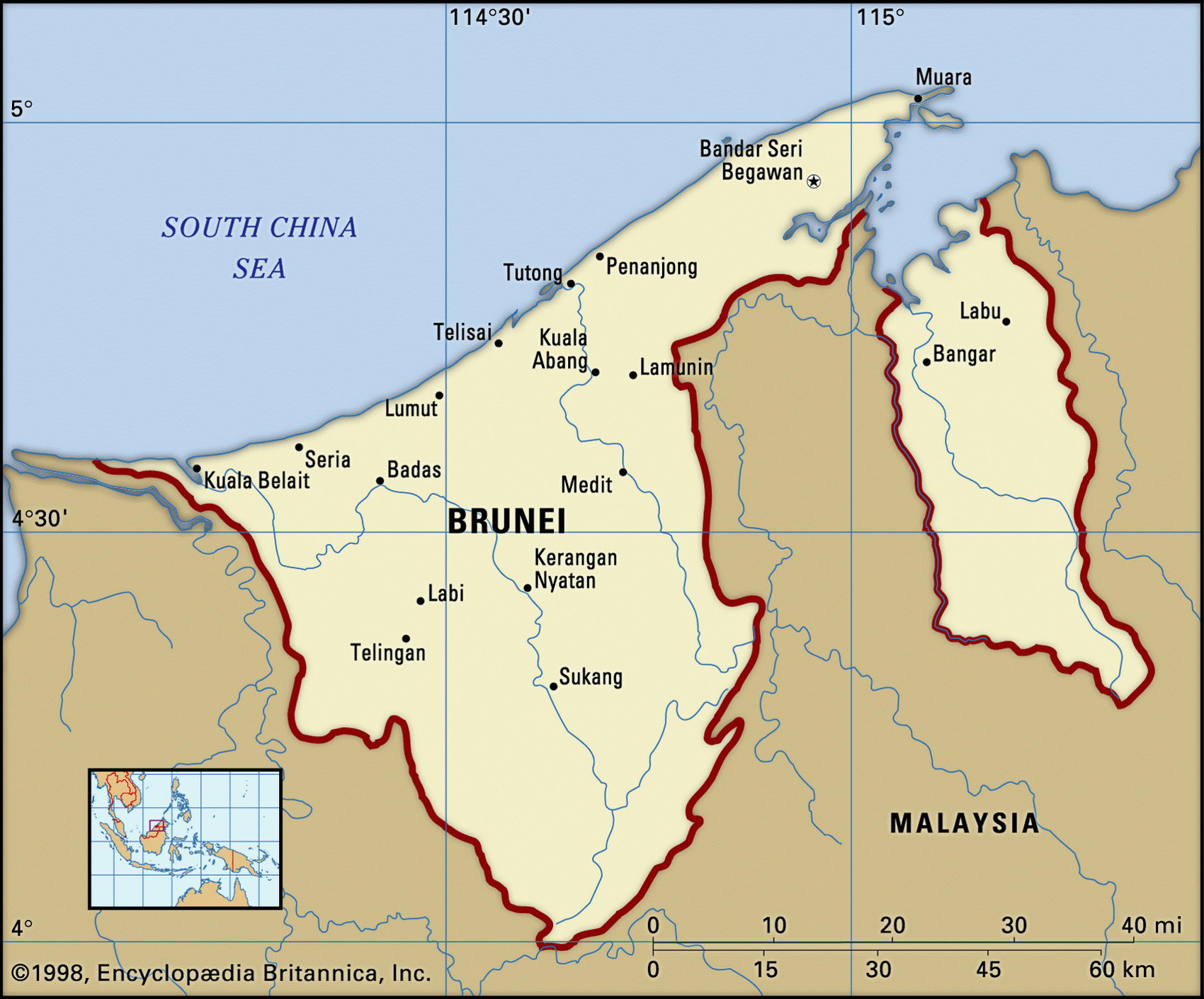
Map of Brunei and geographical facts
Where Brunei on the world map. Map of Brunei
Map of Brunei with cities. Where Brunei is on the world map. The main geographical facts about Brunei - population, country area, capital, official language, religions, industry and culture.

Brunei Fact File
Official name State of Brunei
Form of government Sultanate with advisory council of Cabinet Ministers
Capital Bandar Seri Begawan
Area 5,770 sq km (2,228 sq miles)
Time zone GMT +8 hours
Population 351,000
Projected population 2015 41 7,000
Population density 60.8 per sq km (157,5 per sq mile)
Life expectancy 74.1
Infant mortality (per 1,000) 14
Official languages English, Malay
Other language Chinese, Iban
Literacy rate 88.2%
Religions Muslim 63%, Buddhism 14%, Christian 8%, indigenous beliefs and other 15 %
Ethnic groups Malay 64%, Chinese 20%, other 16 %
Currency Bruneian dollar
Economy Services 87%, industry 9%, agriculture 4%
GNP per capita US$ 18,000
Climate Tropical
Highest point Gunong Pagon 1,850 m (6,070 ft) Map reference Page 201
Oil was discovered in the sultanate of Brunei in 1929. By the time it became independent on 1 January 1984 this small country on the north coast of Borneo was already prosperous. Today its oil revenues have made Brunei's sultan perhaps the richest man in the world, and given its people one of the highest per capita incomes in Asia. There is no income tax, the government subsidizes food and housing, and provides free medical care. The downside is that all government employees (two-thirds of the workforce) are banned from political activity, and the Sultan of Brunei rules by decree. Some nongovernmental political groupings have been allowed but the sultan remains firmly in control. There is disquiet among Bruneians over the rising number of
resident foreigners, as demand for both skilled and unskilled labor brings contract workers in from outside.
Brunei consists of two semi-enclaves on the northwest coast of Borneo which are bordered by the Malaysian state of Sarawak. They are separated by a few kilometers of coastline where the Limbang River enters Brunei Bay. The topography in both areas consists of hills bordering a narrow, swampy coastal plain. More than two-thirds of the country is tropical forest.
Brunei is almost entirely supported by exports of oil and natural gas. Petroleum revenues account for more than 40 percent of gross domestic product. Production is carried out by Brunei Shell Petroleum in which the government holds a 50 percent stake. Most crude oil is exported to Japan, South Korea, Taiwan, and the USA. Liquefied natural gas is produced in one of the world's biggest plants, at Lumut in Malaysia, and is sold to power and gas companies in Tokyo and Osaka. About 80 percent of Brunei's food is imported, but there has been a push to achieve agricultural self-sufficiency. Small farms grow rice, fruit, and vegetables. The government Forestry Department, which controls all forest reserves, is expanding into value-added activities such as furniture production.
Fair in Bandar Seri Begawan, Brunei (above). A view of Singapore's central business district (below). Street vendor with customers in Malaysia (right page bottom).