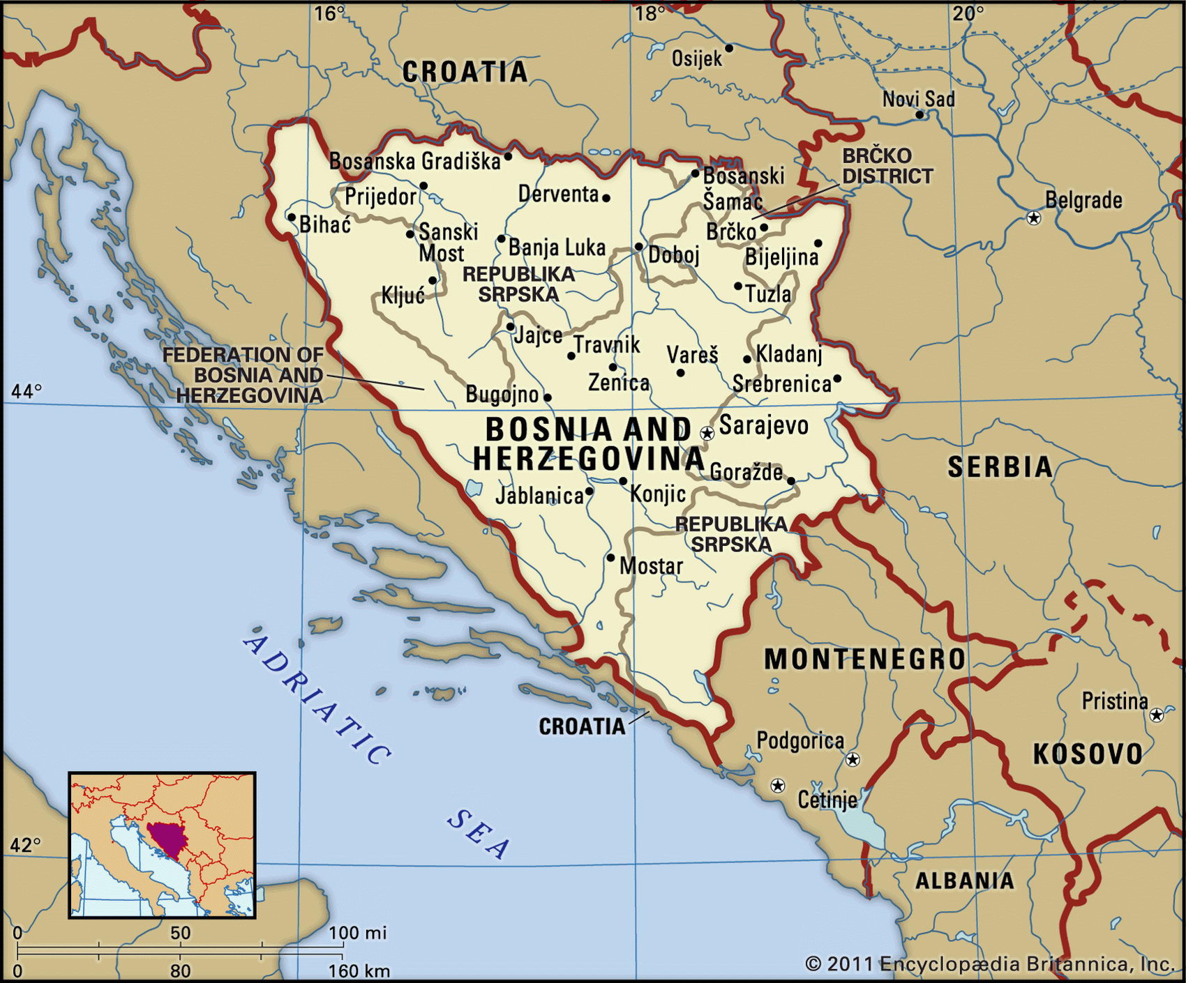
Map of Bosnia and Herzegovina and geographical facts
Where Bosnia and Herzegovina on the world map. Map of Bosnia and Herzegovina
Map of Bosnia and Herzegovina with cities. Where Bosnia and Herzegovina is on the world map. The main geographical facts about Bosnia and Herzegovina - population, country area, capital, official language, religions, industry and culture.

Bosnia and Herzegovina Fact File
GNP per capita US$ 1,800
Official name Republic of Bosnia and Herzegovina
Form of government Federal republic with two legislative bodies (Chamber of Municipalities and Chamber of Citizens)
Capital Sarajevo
Area 51,233 sq km (19,781 sq miles)
Time zone GMT + 1 hour
Population 3,965,000
Projected population 2015 4,279,000
Population density 77.4 per sq km (200.4 per sq mile)
Life expectancy 72.0
Infant mortality (per 1,000) 23.5
Official languages Serbian, Croatian
Literacy rate 82 %
Religions Muslim 40%, Orthodox 31 %, Roman Catholic 15 %, Protestant 4 %, other 10 %
Ethnic groups Serb 40%, Bosnian Muslim 38%, Croat 22 %
Currency Dinar
Economy Not available; war disrupted employment
Climate Cold winters and warm summers; cooler in the north and southern mountains
Highest point Mt Maglic 2,386 m (7,828 ft)
Map reference Pages 294, 296
The federation of Bosnia and Herzegovina has a mere 20 km (12 miles) of coast at its southern tip on the Adriatic. It borders Croatia to the north and west and to the east it shares a border with what remains of the former Yugoslavia, today called Serbia and Montenegro. Serbs first settled in Bosnia in the seventh century ad. In the twelfth century the country came under Hungarian control, and Ottoman Turks conquered it two centuries later. It was ceded to the Austro-Hungarian Empire in 1908, and in 1918 became part of the Kingdom of Serbs, Croats, and Slovenes, which was later renamed Yugoslavia.
The republic was formed in 1994 when, after several years of fighting sparked by the breaking up of Yugoslavia in 1991, Bosnian Croats and Muslims agreed to joint control of the region. Fighting went on for a further 18 months as Bosnian Serbs, backed by Serbia, sought to have a portion of the country incorporated into Serbia. The war came to an uneasy end in 1995 when Serbia abandoned its claims on Bosnian territory. Now named Bosnia and Herzegovina, the country is divided for purposes of administration almost equally between the Muslim-Croat Federation and the Bosnian Serbs.
Much of the land is mountainous and the south consists largely of a harsh limestone plateau. About a quarter of the land, especially in the mountains, is covered in forests of pine and beech. Before the economy collapsed, forestry products were a major source of earnings. Most agriculture is centered in the fertile valley of the Sava River, which forms the border with Croatia. Crops include grapes, other fruit, and cereals. Sheep raising is also significant. Most farms are small and, with the disruption caused by warfare, tend to be inefficient.
Bosnia-Herzegovina imports food and relies heavily on United Nations aid. Years of warfare have brought industry virtually to a standstill. Health and education services have also been severely disrupted.