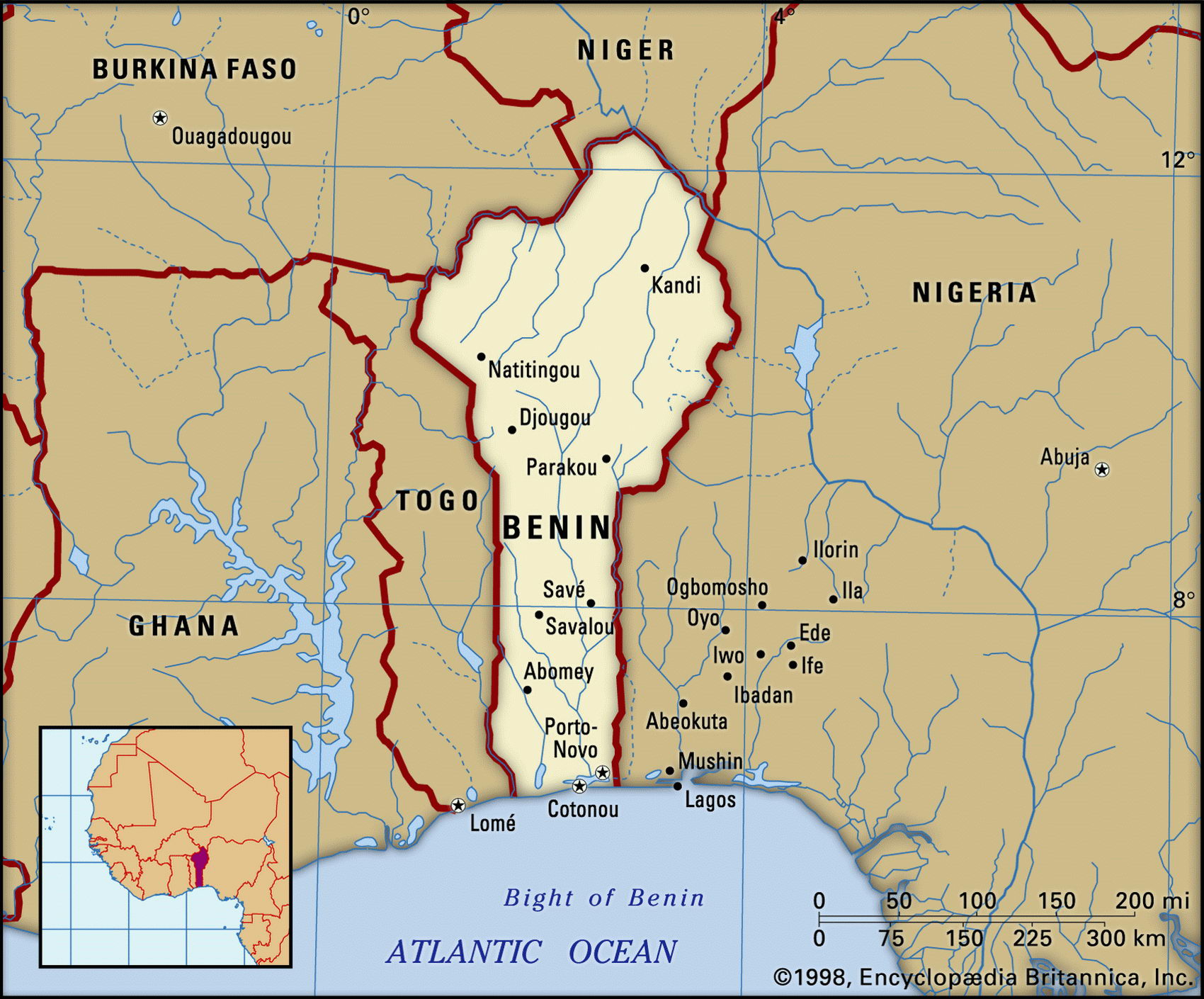
Map of Benin and geographical facts
Benin on the world map. Map of Benin
Map of Benin with cities. Where Benin is on the world map. The main geographical facts about Benin - population, country area, capital, official language, religions, industry and culture.

Benin Fact File
Official name Republic of Benin
Form of government Republic with single legislative body (National Assembly)
Capital Porto-Novo
Area 112,620 sq km (43,483 sq miles)
Time zone GMT + 1 hour
Population 6,788,000
Projected population 2015 9,448,000
Population density 60.3 per sq km (156.1 per sq mile)
Life expectancy 49.7
Infant mortality (per 1,000) 88.5
Official language French
Other languages 60 indigenous languages
Literacy rate 37.5
GNP per capita US$ 1,040
Religions Indigenous beliefs 70%, Muslim 15%, Christian 15%
Ethnic groups Indigenous 99%, European and other 1 %
Currency CFA (Communaute Financiere Africaine) franc
Economy Agriculture 70%, services 23%, industry 7%
Climate Tropical; hot and humid in south, drier in north
Highest point Mt Tanekas 641 m (2,103 ft) Map reference Page 365
Benin is a small west African country facing the Gulf of Guinea. It was once part of the Kingdom of Benin, famous for the brass portrait heads made for the Oba and his court in the fifteenth century. By 1625 it was known as Abomey (later Dahomey). Slavery and slave-raiding were endemic, and grew when firearms and external slave markets became available. The town of Ouidah became the shipping point for several million slaves, mostly prisoners captured in raids by the Dahomeyans against their enemies. The captives were sent mainly to Brazil, and most Afro-Brazilian religious cults derive from this area. Under French control from 1850, the country became independent in I960, eventually falling under the control of General Mathieu Kerekou, who changed its name to Benin. In the 1990s the country slowly moved towards multi-party rule.
The Atakora Range (Chaine de l'Akatora) lies in northwestern Benin. To the northeast are the plains of the Niger, part of the boundary with the state of Niger being formed by the Niger River itself. Further south there are plateaus, and then a fertile plain where the Fon and Yoruba people live as subsistence farmers. Still further south, toward the Bight of Benin, lies a sandy strip with many lagoons. In the country's far north small numbers of Fulani people continue to live as nomads. Also in the north are two wildlife parks— the Pare National de la Pendjan and the Pares Nationaux du W. du Niger—shared with Burkina Faso and Niger.
Subsistence agriculture, cotton production, and regional trade remain fundamental to Benin's economy. Offshore oilfields promised much when they began producing in 1982, but were soon affected by a fall in petroleum prices. As well as crude oil Benin sells cotton, palm-oil products, cocoa, and peanuts. Goods in transit through the port of Cotonou to Niger are charged a fee, and this is an additional source of revenue. Although a World Bank reform program was adopted in 1992, inefficient state enterprises and an overstaffed civil service are inhibiting economic progress.