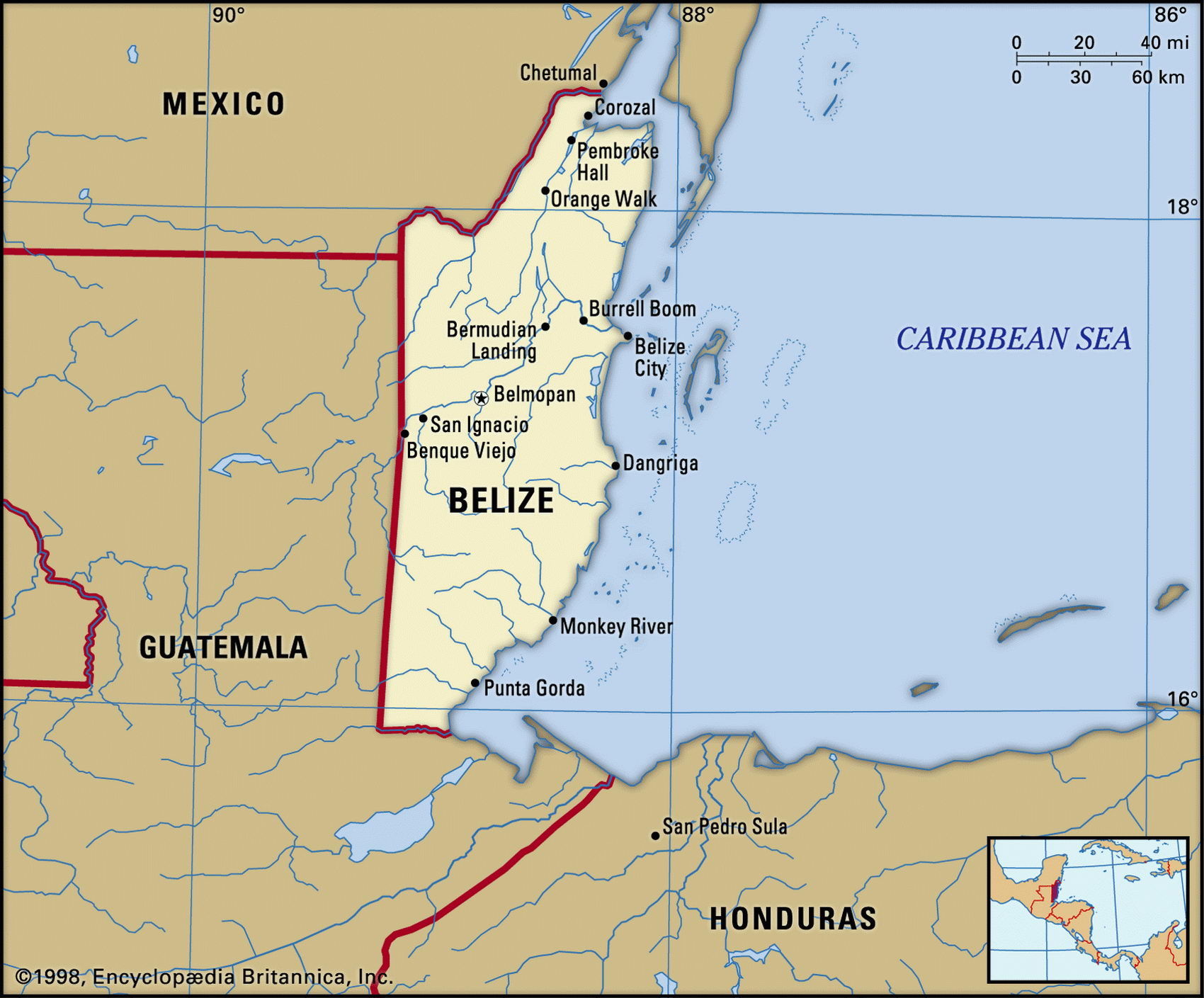
Map of Belize and geographical facts
Belize map with cities. Belize on the world map
Map of Belize with cities. Where Belize is on the world map. The main geographical facts about Belize - population, country area, capital, official language, religions, industry and culture.

Belize Fact File
Official name Belize
Form of government Constitutional monarchy with two legislative houses (Senate and National Assembly)
Capital Belmopan
Area 22,960 sq km (8,865 sq miles)
Time zone GMT - 6 hours
Population 263,000
Projected population 2015 287,000
Population density 11.5 per sq km (29.7 per sq mile)
Life expectancy 71.5
Infant mortality (per 1,000) 24.3
Official language English
Other languages Spanish, Mayan and Garifunan languages, German
Literacy rate 70.3%
Religions Roman Catholic 62%, Protestant 30% none 2 %, other 6 %
Ethnic groups Mixed indigenous-European 44% African 30%, Maya 11 %, Garifuna 7%, other 8c
Currency Belizean dollar
Economy Services 60%, agriculture 30%, industry 10%
GNP per capita US$ 3,250
Climate Tropical, with wet seasons June to July and September to January
Highest point Victoria Peak 1,160 m (3,806 ft)
Map reference Page 428
Belize lies on the eastern side of the Yucatan Peninsula. Bordering Mexico to the north and Guatemala to the west and south, it was the last country in the Americas to achieve independence. This came in 1981. Formerly known as British Honduras, its original inhabitants were Maya Indians, with a few Carib Indians along the coast. Though adjacent territory was conquered by the Spanish in the sixteenth century, the first recorded European settlers in the area were British woodcutters in the seventeenth century. At a later date sugar plantations worked by African slaves were established. When Guatemala became independent in 1821 it laid claim to British Honduras and the sovereignty issue strained relations between the two countries until Guatemala officially recognized Belize as an independent country in 1993.
The northern part of the country is a swampy plain. In the south the Maya Mountains continue from Guatemala in a northeasterly direction, dividing the coastal plain from the interior. Victoria Peak, on a spur of this range, is flanked by tropical forest, grasslands, and farming regions. Rainforests containing jaguar still cover nearly half the country and in the rivers there are crocodile and manatee. The world's second longest coral reef lies offshore. Belize is much affected by hurricanes. After the 1961 hurricane that destroyed Belize City the capital was moved inland to Belmopan.
Agriculture employs more than a quarter of the labor force, and is the mainstay of the economy. The main domestic staples are maize, rice, kidney beans, and sweet potatoes. Belize enjoyed a boom in the years following independence, citrus fruit processing and tourism helping to reduce the earlier dependence on timber, bananas, and sugar. Sugar still accounts for about thirty percent of export earnings. Timber has lost importance, but the forests still produce valuable rosewood, mahogany, and chicle used for chewing gum. Fisheries specialize in lobsters and shrimp.