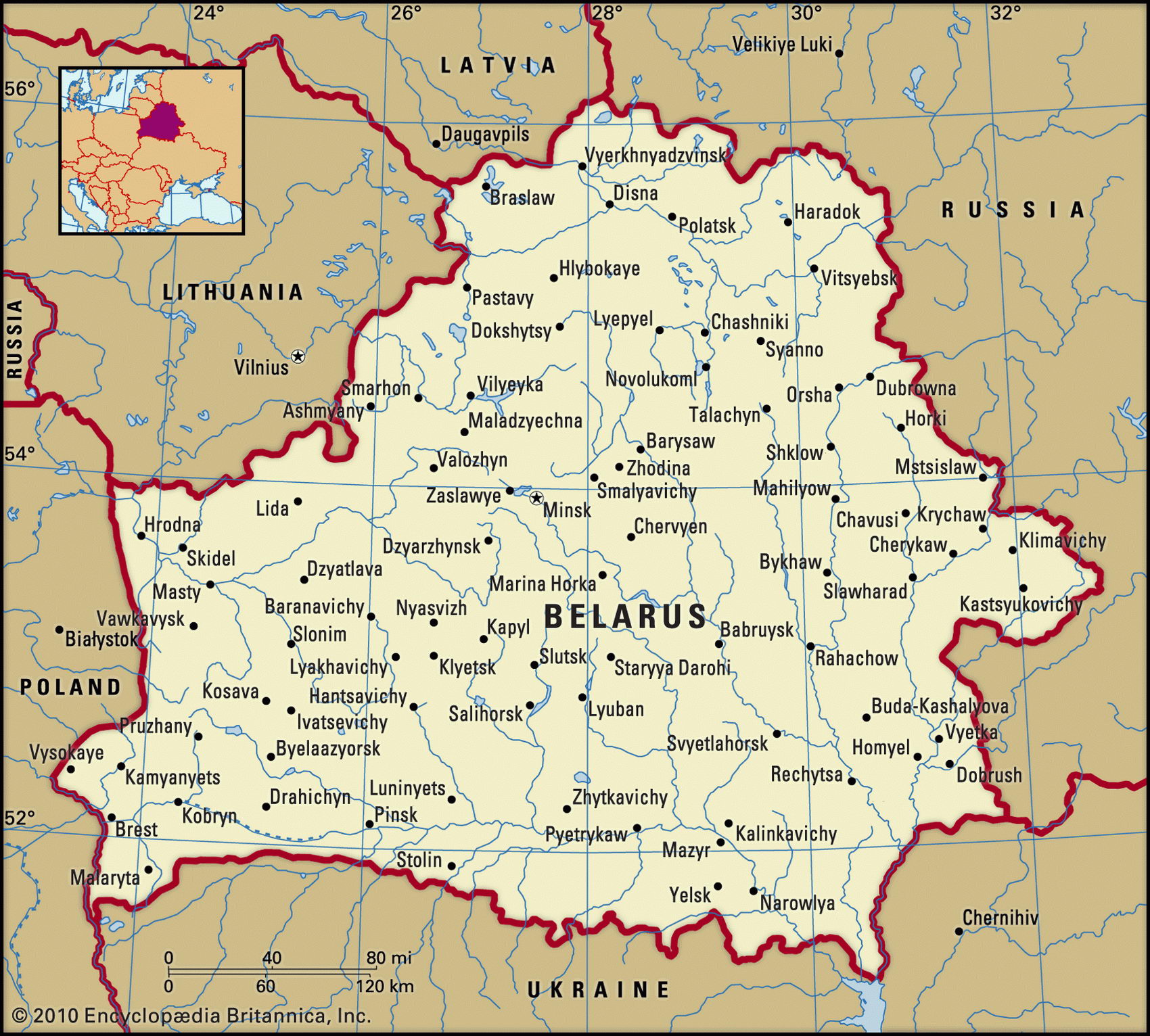
Map of Belarus and geographical facts
Belarus on the world map. Map of Belarus
Map of Belarus with cities. Where Belarus is on the world map. The main geographical facts about Belarus - population, country area, capital, official language, religions, industry and culture.

Belarus Fact File
Official name Republic of Belarus
Form of government Republic with single legislative body (Supreme Soviet)
Capital Minsk
Area 207,600 sq km (80,154 sq miles)
Time zone GMT + 2 hours
Population 10335,000
Projected population 2015 9,664,000
Population density 49.8 per sq km (128.9 per sq mile)
Life expectancy 68.3
Infant mortality (per 1,000) 14.1
Official language Belarusian
Other language Russian, languages of the minorities
Literacy rate 98 %
Religions Eastern Orthodox 60%, other (including Roman Catholic and small Muslim and Jewish communities) 40%
Ethnic groups Belarusian 78%, Russian 13%, Polish 4%, Ukrainian 3%, other 2%
Currency Belarusian ruble
Economy Industry 40%, services 39%, agriculture 21 %
GNP per capita US$ 8,200
Climate Temperate, with cold winters and mild, wet summers
Highest point Mt Dzyarzhynskaya 346 m (1,135 ft) Map reference Pages 287, 299, 300
Until 1991, when it declared its independence of the disintegrating Soviet Union, Belarus was known as the Byelorussian (which means "White Russian") Soviet Socialist Republic. Throughout its extensive and troubled history, Belarus has been dominated, invaded, and sometimes devastated by a succession of foreign powers. Initally settled by Slavic tribes in the sixth century ad, the country came under the control of Kiev in the ninth century. Three centuries later it was conquered by invading armies from neighboring Lithuania and in the sixteenth century, with the merging of Lithuania and Poland, Polish influences were also dominant. During the course of the eighteenth century the region came under Russian control and even today Belarus is economically dependent on its huge and powerful eastern neighbor.
Belarus was ravaged in the First and Second World Wars. The German invasion of 1941 saw the deaths of 1.3 million people and the virtual annihilation of the country's Jewish population. Many of Belarus's buildings were reduced to rubble and its capital, Minsk, was razed. Further devastation, in the form of nuclear contamination, occurred in 1986 after the Chernobyl disaster in Ukraine, its neighbor to the south. Much of the farming land in the southern part of Belarus remains contaminated by fallout from the accident and is unsafe for cultivation.
The country is generally low-lying, the landscape varying from sandy hills in the north to swampy areas in the south, many of which have been drained and their rich soils cultivated. There are about 11,000 lakes and the country is traversed by numerous rivers, which complement the extensive road and railway networks as a major means of transportation. Forests and woodland cover about thirty percent of the country and almost half the land area is devoted to agriculture, the main crops being barley, rye, potatoes, sugar beet, and flax. There are large numbers of livestock, and dairy and pig farming are important industries.
Belarus is relatively poor in natural resources although it has significant reserves of peat and rock salt and small reserves of coal. It is deeply in debt to the Russian Federation and relies on Russia for the electricity needed to power its industries, which include vast petrochemical plants and truck manufacturing.
Strikes and industrial and political unrest have been a significant feature of Belarusian life during its short period as an independent nation, sometimes aggravated by the inability of the government to pay many of its workers. A controversial treaty signed with Russia in 1996 resulted in a substantial merging of aspects of the economy with that of its large neighbor. This was seen by many as a sign of a progressive whittling away of the country's independence.