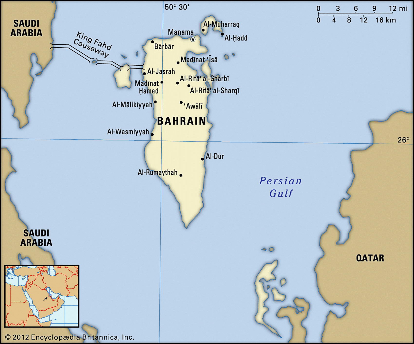
Map of Bahrain and geographical facts
Where Bahrain is on the world map
Map of Bahrain with cities. Where Bahrain is on the world map. The main geographical facts about Bahrain - population, country area, capital, official language, religions, industry and culture.

Bahrain Fact File
Official name State of Bahrain
Form of government Traditional monarchy
Capital Al Manamah (Manama)
Area 620 sq km (239 sq miles)
Time zone GMT + 3 hours
Population 657,000
Projected Population 2015 793,000
Population density 1,059.7 per sq km (2,749.0 per sq mile)
Life expectancy 73.5
Infant mortality (per 1,000) 19.2
Official language Arabic
Other languages English, Farsi (Persian), Urdu
Literacy rate 88.5 %
Religions Shi'a Muslim 75%, Sunni Muslim 25%
Ethnic groups Bahraini 63 %, Asian 13 %, other Arab 10%, Iranian 8%, other 6%
Currency Bahraini dinar
Economy Industry and commerce 85%, agriculture 5%, services 7%, government 3%
GNP per capita US$ 13,000
Climate Mainly arid, with mild winters and hot, humid summers
Highest point Jabal ad Dukhan 122 m (400 ft) Map reference Page 220
The State of Bahrain is a cluster of 35 small, low-lying islands located in the Persian Gulf, just 28 km (17 miles) from the west coast of the Qatar Peninsula. The islands were once the heart of the ancient Dilmun civilization and have been a trading center for more than 4,000 years. Bahrain was the first of the Gulf States to export oil, soon after reserves were discovered in 1932. A 25 km (16 mile) causeway links the main island to Saudi Arabia.
After the collapse of Beirut in Lebanon in the 1970s, which previously had been the region's main commercial center, Bahrain began to provide banking and financial services, at the same time increasing its transport and communication facilities. When the elected assembly was dissolved in 1975 and the country reverted to traditional authoritarian rule, there was growing unrest among the fundamentalist Shi'ite Muslim majority. Encouraged in their resistance by Iran, the Shi'ites resent their low status under Bahrain's Sunni Muslim ruling family. In the opinion of Shi'ite fundamentalists this family is unacceptable for a number of reasons: It belongs to a branch of Islam they regard as oppressive, it is liberal and modernizing in its economic policies, and it is a supporter of US policy. US military air bases on Bahrain were essential strategic assets during the 1990-91 Gulf War.
Consisting of barren rock, sandy plains, and salt marshes, the landscape of Bahrain is low-lying desert for the most part, rising to a low central escarpment. Winters are dry and mild, summers hot and humid. There are no natural freshwater resources. All the country's water needs must be met by groundwater from springs and from desalinated sea water. Imported soil has been used to create several small fertile areas, and domestic agricultural production is actually capable of meeting local demand for fruit and vegetables. However, the degradation of the existing arable land is an environmental concern, along with damage to coastlines, coral reefs, and sea life resulting from spills of oil and oil-tanker discharges.
Waning oil production since the 1970s has forced Bahrain to diversify its economy. Since the opening of the causeway linking the country to Saudi Arabia in 1986 there has been a boom in weekend tourism, with visitors pouring in from the Gulf States. Bahrain is now the Arab world's most important banking center, and numerous multinational firms with business in the Gulf have offices in the country. Ship repairs are also undertaken in Bahrain. Petroleum production and processing account for approximately eighty percent of export receipts. Natural gas has assumed greater importance, and is used to supply local industries, including an aluminum smelting plant. However, unemployment among the young, especially among the Shi'ite majority, is a cause of social unrest and continuing economic concern.