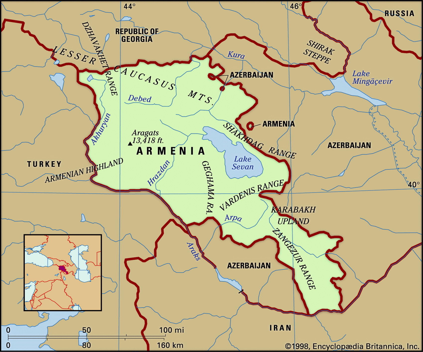
Map of Armenia and geographical facts
Armenia on the world map. Map of Armenia
Map of Armenia with cities. Where Armenia is on the world map. The main geographical facts about Armenia - population, country area, capital, official language, religions, industry and culture.

Armenia Fact File
Official name Republic of Armenia
Form of government Republic with single legislative body (National Assembly)
Capital Yerevan
Area 29,800 sq km (11,506 sq miles)
Time zone GMT + 4 hours
Population 3,330,000
Projected population 2015 3,808,000
Population density 111.7 per sq km (289.4 per sq mile)
Life expectancy 66.6
Infant mortality (per 1,000) 41.1
Official language Armenian
Other language Russian
Literacy rate 99 %
Religions Armenian Orthodox 94%, other (Russian Orthodox, Muslim, Protestant) 6%
Ethnic groups Armenian 93%, Azeri 3%, Russian 2%, other (mainly Kurdish) 2%
Currency Dram
Economy Industry 28%, agriculture 27%, services 26%, other 19%
GNP per capita US$ 3,350
Climate Mainly dry, with cold winters and warm summers; cooler in mountains
Highest point Aragats Lerr 4,090 m (13,419 ft)
Map reference Page 222
Armenia is a small, mountainous, Christian country, landlocked between hostile Muslim neighbors. To the east is Azerbaijan, and to the west is Turkey, which inflicted genocidal massacres on the Armenian people between 1894 and 1915. The legendary resting place of Noah's Ark after the Flood (its capital supposedly founded by Noah himself), Armenia had already existed as a distinct country for 1,000 years when in the fourth century ad it became the first in the world to make Christianity its state religion. The country has been fought over at various times by Romans, Persians, and Mongols. It became a Soviet Socialist Republic in 1922 and gained its independence from the Soviet Union in 1991. In 1988 there was a devastating earthquake which killed 25,000 people and destroyed power stations and other infrastructure, and in the same year conflict began over Nagorno-Karabakh, an internal Azerbaijani area largely populated by Christian Armenians which is claimed by Armenia.
The mountains of the Lesser Caucasus (Malyy Kavkaz) cover most of the country. The landscape is rugged, and includes extinct volcanoes and high lava plateaus cut with ravines. An active seismic area, the frequency of earthquakes in Armenia indicates that mountain-building is still taking place. Although the city of Ararat is in Armenia, Mt Ararat itself is across the border in Turkey. The centrally located Lake Sevan (Sevana Lich) lies nearly 2,000 m (6,000 ft) above sea level, but its use for hydropower has drained it to a point where drinking water supplies are threatened. Steppe vegetation is the main cover and drought-resistant grasses and sagebrush grow on the lower mountain slopes, where jackals, wildcats, and the occasional leopard are found.
As a Soviet Republic, Armenia developed an industrial sector, supplying machine building tools, textiles, and other manufactured goods to other republics in return for raw materials and energy. It has few natural resources, although formerly lead, copper, and zinc were mined, and there are deposits of gold and bauxite. Agriculture is an important source of income. In irrigated areas around Yerevan, crops include grapes, almonds, figs, and olives, while apples, pears, and cereals are grown on higher ground. Armenia is also known for its quality brandies and wines. Economic decline in the period from 1991 to 1994 was a direct result of the ongoing conflict over Nagorno-Karabakh. In retaliation for Armenia's military activities in the region, Turkey and Azerbaijan blockaded pipeline and railroad traffic into the country, causing chronic energy shortages. There have been improvements, but full economic recovery is unlikely before Armenia's conflict with its neighbors is settled.
A yurt in the Pamir region of Tajikistan (left page top). View over the city of Yerevan in Armenia, with Mt Ararat in the background (below).