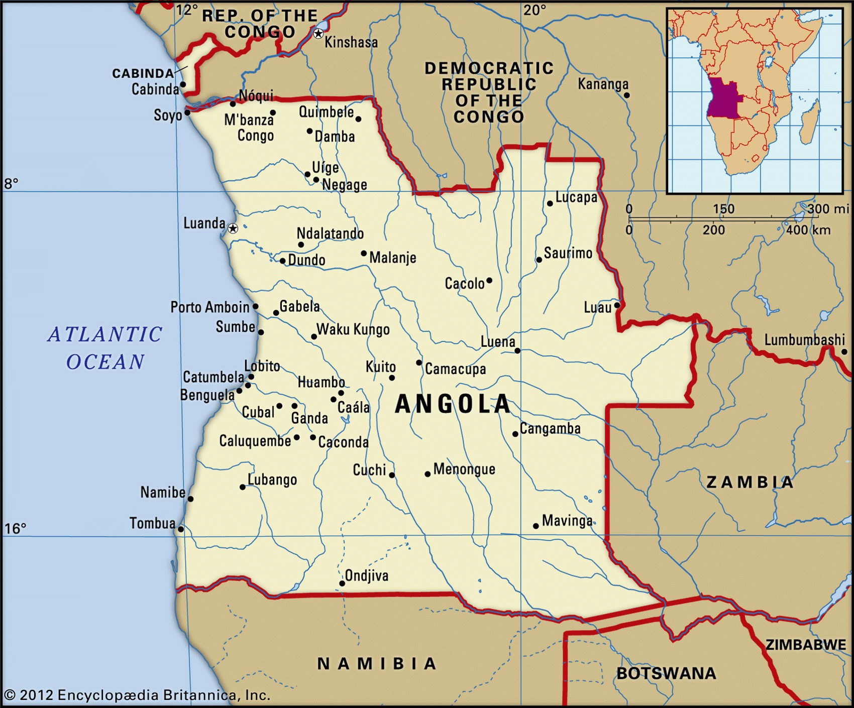
Map of Angola and geographical facts
Angola on the world map. Map of Angola
Map of Angola with cities. Where Angola is on the world map. The main geographical facts about Angola - population, country area, capital, official language, religions, industry and culture.

Angola Fact File
Official name Republic of Angola
Form of government Republic with single legislative body (National Assembly)
Capital Luanda
Area 1,246,700 sq km (481,351 sq miles)
Time zone GMT+1 hour
Population 10,979,000
Projected population 2015 13,548,000
Population density 8.8 per sq km (22.8 per sq mile)
Life expectancy 38.9
Infant mortality (per 1,000) 131.7
Official language Portuguese
Other languages Bantu, other African languages
Literacy rate 42 %
Religions Indigenous beliefs 47%, Roman Catholic 38%, Protestant 15 %
Ethnic groups Mainly indigenous, including Ovimbundu 37%, Kimbundu 25%, Bakongo 13%; mixed European-African 2%, European 1 %, other 22 %
Currency Kwanza
Economy Industry 67%, services 25%, agriculture 8%
GNP per capita US$ 1,900
Climate Mainly tropical with wet season November to April; semiarid in south and along coast
Highest point Mt Moco 2,620 m (8,596 ft)
Map reference Pages 368, 370
Alarge country on Africa's southwest coast, Angola is bordered by the states of the Democratic Republic of the Congo to the north, Zambia to the east, and Namibia to the south. The small but resource-rich province of Cabinda lies separated from the rest of Angola to the north of the Congo River, wholly surrounded by Congo.
A Portuguese colony since the sixteenth century, Angola was the source of an estimated three million slaves who were sent to Brazil and other places across the Atlantic, largely to work on sugar plantations. The country received its independence in 1975 and for the next twenty years was wracked by civil war. The government, having established a Marxist one-party state supported by the USSR and especially Cuba, was then challenged by the forces of Jonas Savimbi, who was backed by the USA. The truce mediated between the two parties by the United Nations, which came into force in 1994, did not last for long. A national unity government was installed in 1997, but serious fighting resumed in late 1998, rendering hundreds of thousands of people homeless. After the death of Jonas Savimbi in 2002 both parties stopped fighting after an
A village In the Congo highlands (left page bottom). Dusk on the Congo River in the Democratic Republic of the Congo (left). Angolan women pounding millet in the traditional way (below).
estimated 1.5 million people had lost their lives in fighting over the past quarter of a century. The reconstruction of the devastated country and the reconciliation of the different groups are the most pressing issues for the current government, but there is hope that the country finally may come to rest.
Angola can be divided into two main regions. There are the relatively narrow coastal plains, and an extensive tableland that rises from them and dominates the rest of the country. Divided roughly east to west across the center, this tableland drains into the Congo Basin to the north, and into the rivers of the Zambeze Basin to the south and east. While the tableland is fairly level in the south, the highlands become mountainous in central and southwestern Angola. In the province of Cabinda there are dense tropical rainforests, and heavy rains can be expected for seven months of the year. Savanna woodland is found on much of the tableland, becoming mainly grassy plains to the south, dotted with acacia and baobab trees. The cold Benguela current that flows north from the southern Atlantic Ocean has a moderating effect on the heat of the coastal region. Toward Namibia on the southern border the coastal strip becomes desert.
Angola is rich in petroleum, gold, and diamonds, and has reserves of iron ore, phosphates, feldspar, bauxite, and uranium. It has large areas of forest, productive fisheries off the Atlantic coast, and extensive areas of arable land. While the country is capable of producing coffee, sisal, and cotton, the years of civil war have resulted in economic disarray and the country's output per capita for many years was one of the lowest in the world. Subsistence agriculture supported up to ninety percent of the people and much of the nation's food still has to be imported.
Region Central Africa