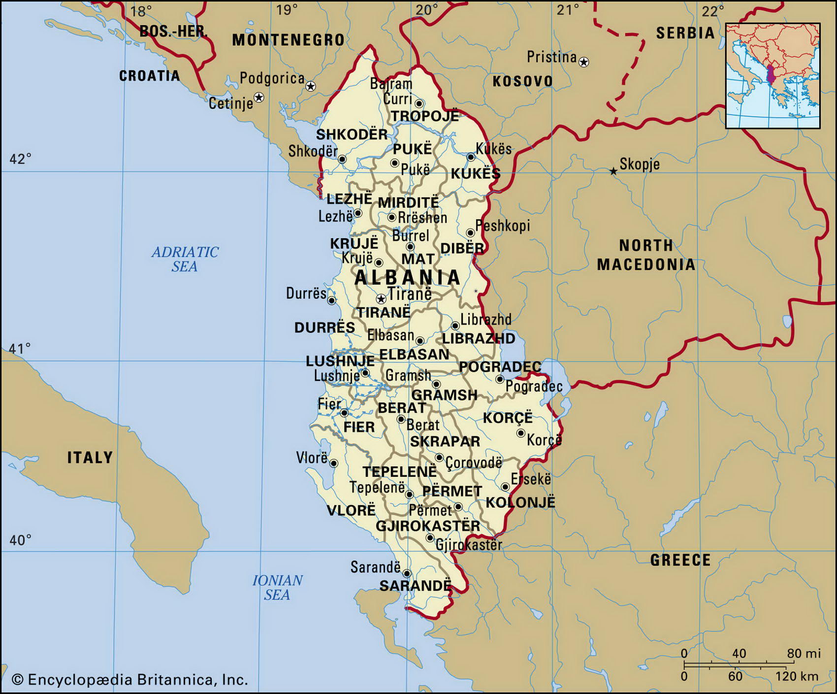
Map of Albania and geographical facts
Albania on the world map. Map of Albania
Map of Albania with cities. Where Albania is on the world map. The main geographical facts about Albania - population, country area, capital, official language, religions, industry and culture.

Albania Fact File
Official name Republic of Albania
Form of government Republic with single legislative body (National Assembly)
Capital Tirane
Area 28,750 sq km (11,100 sq miles)
Time zone GMT + 1 hour
Population 3,545,000
Projected population 2015 3,439,000
Population density 123.3 per sq km (319.4 per sq mile)
Life expectancy 72.1
Infant mortality (per 1,000) 38.6
Official language Albanian
Other languages Greek, Macedonian
Literacy rate 93 %
Religions Muslim 70%, Albanian Orthodox 20%, Roman Catholic 10%
Ethnic groups Albanian 95%, Greek 3%, other 2( Currency Lek
Looking across the Danube in Budapest, Hungary (left page). The fourteenth-century citadel of Gjirokaster in Albania (above).
Economy Agriculture 56%, industry 21 %, services 23%
GNP per capita US$ 4,500
Climate Mild temperate with cold, wet winters and warm, dry summers; colder in mountains
Highest point Maja e Korabit 2,753 m (9,032 ft)
Map reference Pages 296-97
Albania shares borders with Greece to the southeast and Macedonia to the east. Serbia and Montenegro wraps around the northern part of the country. At its western edge it has a coastline 362 km (225 miles) long along the Adriatic Sea. For 500 years until 1912, when it became independent, Albania was part of the Ottoman Empire, and a large majority of the population is Muslim. In 1912 it declared its independence and in 1939 Albania was invaded by Italy. After the Second World War the country came into the Soviet sphere of influence. From 1946 until 1992 Albania was part of the Soviet bloc, although it often adopted policies independent of, and sometimes at odds with, the Moscow line. When the European communist system unraveled in the early 1990s Albania, in 1992, was the last country in Europe to abandon a communist regime.
Except for a narrow strip of plains along its coastline, Albania is hilly and mountainous. Most Albanian people eke out an existence through farming on the plains, which contain the only cultivable land. Even here, much of the country is marshy and difficult to access. Corn, wheat, barley, and fruits are among the main crops. Little is exported because transport methods are primitive. In most areas people use horse- or mule-drawn vehicles. Mountains cover seven-tenths of the country. In the north are the Albanian Alps, and there are highlands in the center and south. Numerous rivers, notably the Drin in the north, and the Vijose in the south, flow to the coast from the highlands. Albania has significant reserves of natural resources such as petroleum, iron, and other mineral ores, plus natural gas, but most remain undeveloped.
The mountainous landscape makes land access difficult, and marshes restrict access to much of the coast. Rail links are few and there are no railway lines to neighboring countries. This has contributed to Albania's relative cultural and linguistic distinctness. Despite its conversion to free market ideals, Albania has failed to emerge from the cycle of poverty, continuing food shortages, and violence, fed to a large extent by the flood of refugees from the troubles in former Yugoslavia.