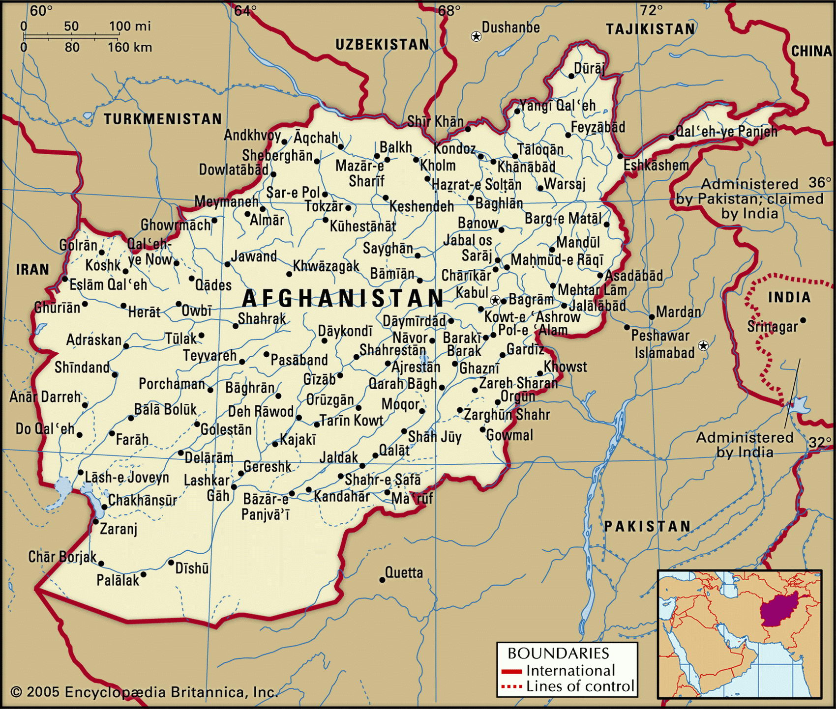
Map of Afghanistan and geographical facts
Afghanistan on the world map. Map of Afghanistan
Map of Afghanistan with cities. Where Afghanistan is on the world map. The main geographical facts about Afghanistan - population, country area, capital, official language, religions, industry and culture.

Afghanistan Fact File
Region Central and West Asia
Afghanistan GNP per capita US$ 800
Official name Islamic State of Afghanistan
Form of government Transitional government
Capital Kabol (Kabul)
Area 647,500 sq km (250,000 sq miles)
Time zone GMT + 4.5 hours
Population 27,756,000
Projected population 2015 35,577,000
Population density 42.9 per sq km (111 per sq mile)
Life expectancy 46.6
Infant mortality (per 1,000) 144.8
Official languages Dari (Afghan Persian), Pashto
Other languages Uzbek, Turkmen, Indi and Pamiri languages, Dravidian
Literacy rate 36%
Religions Sunni Muslim 84%, Shi'a Muslim 15%, other 1 %
Ethnic groups Pashtun 38%, Tajik 25%, Hazara 19 %, Uzbek 6 %, other 12%
Currency Afghani
Economy Agriculture 61 %, services 25%, industry 14%
Climate Mainly semiarid, but arid in southwest and cold in mountains; hot summers and cold winters
Highest point Nowshak 7,485 m (24,557 ft)
Map reference Page 221
Afghanistan is a landlocked country in the central part of South Asia with nearly three-quarters of its territory mountainous. It shares a western frontier with Iran, while Pakistan is across the southeastern border. Once a part of the ancient Persian Empire, Afghanistan was conquered by Alexander the Great in 328 вс. In the seventh century ad it adopted Islam. From 1953 it was closely allied with the former Soviet Union. In 1979 the Soviet government intervened to install a communist faction, and though constantly beseiged by mujahideen guerrilla fighters, maintained its military occupation until 1989. After the overthrow of the communist government in 1992 the mujahideen began fighting among themselves along ethnic lines. In 1996-2001, the Sunni Muslim Taliban militia, associated with the majority Pashtun, was in control of the country and imposed a strict Islamic rule, but was overthrown in late 2001 by an international alliance.
Geographically, the country's largest area is the thinly populated central highlands. This comprises most of the Hindu Kush, the second highest range in the world, with several peaks over 6,400 m (21,000 ft). The northeast is seismically active. Much of the rest is desert or semidesert, except for a few fertile and heavily populated valleys, among them Herat in the northwest. Most agriculture takes place on the northern plains, near the frontiers of Turkmenistan, Uzbekistan, and Tajikistan. The country's main river basins are those of the Amu Darya, Helmand, and Kabol.
Afghanistan is very poor: a list of 192 countries ranked for calorie intake in 1995 placed Afghanistan 191. It depends largely on wheat farming and the raising of sheep and goats. During the Soviet occupation and the subsequent internecine conflict, one-third of the population left the country, 6 million refugees fleeing to Pakistan and Iran. Many have now gone home to an economically devastated land. Millions of people lack food, clothing, housing, and medical care. Though data are shaky, it is likely that the country's most profitable crop is opium, Afghanistan reputedly being the world's second largest producer after Myan-mar (Burma), and a major source of hashish.