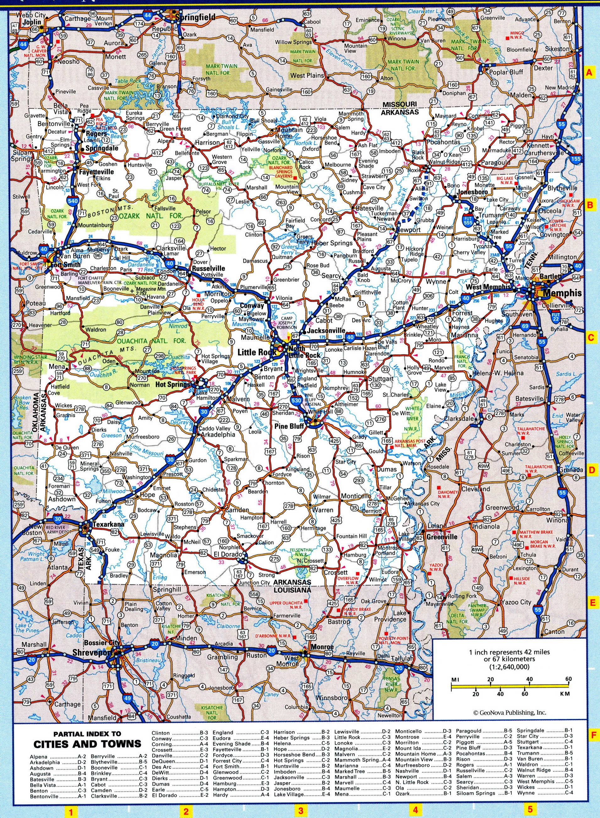
Arkansas map with cities and towns, rivers and lakes, parks and recreation
Map of Arkansas national parks
Arkansas map with national parks and recreation area. Free online map of Arkansas national parks, forests, preserve, recreation areas and monuments.

List of National Parks of Arkansas state
Hot Springs National Park
List of National Forests of Arkansas state
Ozark National Forest Arkansas 1908
St. Francis National Forest Arkansas 1908
Ouachita National Forest Arkansas, Oklahoma 1907
State Parks of Arkansas
Bull Shoals State Park
Cane Creek State Park
Conway Cemetery State Park
Crater of Diamonds State Park
Crowley Ridge State Park
Daisy State Park
De Gray State Park
Devils Den State Park
Jacksonport State Park
Jenkins Ferry State Park
Lake Catherine State Park
Lake Charles State Park
Lake Chicot State Park
Lake Dardanelle State Park
Lake Fort Smith State Park
Lake Frierson State Park
Lake Ouachita State Park
Lake Poinsett State Park
Logoly State Park
Lost Valley State Park
Mammoth Spring State Park
Millwood State Park
Moro Bay State Park
Mount Magazine State Park
Mount Nebo State Park
Old Davidsonville State Park
Petit Jean State Park
Pinnacle Mountain State Park
Poison Springs State Park
Prairie Grove Battlefield State Park
Queen Wilhelmina State Park
Toltec Mounds State Park
Village Creek State Park
White Oak Lake State Park
Withrow Springs State Park
Woolly Hollow State Park
State Forest of Arkansas
Poison Springs State Forest
State Historic Site
Old Washington Historic State Park
State Fish Hatcherys
Centerton State Fish Hatchery
Hogan State Fish Hatchery
State Natural Area
Cossatot River State Park-Natural Area