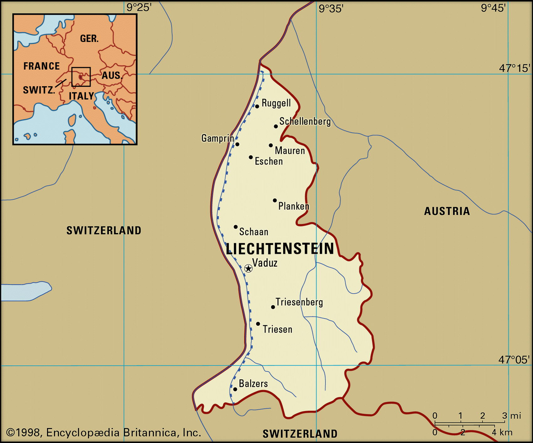
Liechtenstein map with cities. Liechtenstein geographical facts
Liechtenstein on Europe map. Geographical facts about Liechtenstein
Map of Liechtenstein with cities and administrative borders. Where Liechtenstein is on the map of Europe.

Liechtenstein Fact File
Official name Principality of Liechtenstein
Form of government Constitutional monarchy with single legislative house (Parliament)
Capital Vaduz
Area 160 sq km (62 sq miles)
Time zone GMT+1 hour
Population 32,800
Projected population 2015 37,000
Population density 205.0 per sq km (529.0 per sq mile)
Life expectancy 79.1
Infant mortality (per 1,000) 4.9
Official language German
Literacy rate 100c.
Religions Roman Catholic 87.3%, Protestant 8.3( other 4.4%
Ethnic groups Alemannic 95%, Italian and other 5 %
Currency Swiss franc
Economy Services 50.2%; industry, trade and building 48.1 %; agriculture, fishing and forestry 1.7%
GNP per capita US$ 23,000
Climate Temperate, with cold, wet winters and mild, humid summers
Highest point Grauspitz 2,599 m (8,527 ft) Map reference Page 288
This small Central European country sits high in the Alps. To the west the Rhine River forms a border with Switzerland, with which Liechtenstein has political ties and whose currency it shares. Austria lies to the east and south. The country takes its name from the Austrian Liechtenstein family which, in 1699 and 1713, acquired two fiefdoms and formed them into the principality. It later came under French and then German influence. In 1866 it achieved independence, and two years later declared itself permanently neutral, a position it has since maintained. In all subsequent European wars, Liechtenstein has remained unmolested. Its head of state is an hereditary monarch who appoints a government on the recommendation of an elected parliament. Elections are held every four years and there is universal adult suffrage, although women have had the vote only since 1984.
The Rhine is the source of Liechtenstein's agricultural strength. Its floodplain, once marshy, has been drained and reclaimed for agricultural and pastoral use. The capital sits on a plateau overlooking the undulating expanses of the Rhine Valley. The slopes of the Rhatikon alpine range rise to impressive peaks in the south. From the southern highlands, the Samina River flows northward through the center of the country. Thick forests—of beech, maple, and ash—cover much of the mountain region.
The main agricultural industries are cattle, sheep, and pig raising, and some vegetables and cereal crops are grown. There is little heavy industry but prominent among light industries are textile and ceramic goods and the manufacture of electronic equipment. There are no mineral resources, and Liechtenstein imports all its fuel and raw materials. A major source of revenue is the sale of postage stamps. More than half the country's residents are foreign nationals, largely attracted by the country's low rates of taxation and its banking laws, which ensure great secrecy. The population's living standard is very high and the unemployment rate around 1.3 percent. The organization of health care is closely linked to the adjacent Swiss cantons.